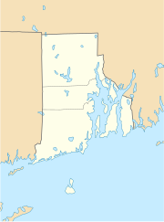
Hopkinton (Rhode Island)
| Hopkinton | ||
|---|---|---|
|
Location in Rhode Island
|
||
| Basic data | ||
| State : | United States | |
| State : | Rhode Island | |
| County : | Washington County | |
| Coordinates : | 41 ° 28 ′ N , 71 ° 47 ′ W | |
| Time zone : | Eastern ( UTC − 5 / −4 ) | |
| Residents : | 8,188 (as of 2010) | |
| Population density : | 71.6 inhabitants per km 2 | |
| Area : | 114.3 km 2 (approximately 44 mi 2 ) | |
| Height : | 51 m | |
| Postcodes : | 02804 (Ashaway), 02808 (Bradford), 02833 (Hopkinton City), 02832 (Hope Valley), 02873 (Rockville), 02898 (Wyoming) | |
| Area code : | +1 401 | |
| FIPS : | 44-35200 | |
| GNIS ID : | 1217663 | |
| Website : | hopkintonri | |
Hopkinton is a town in Washington County in the US -amerikanischen state Rhode Iceland . In 2010 there were 8188 residents in Hopkinton.
geography
Hopkinton is at 41 ° 27'40 "north latitude and 71 ° 46'39" west longitude. Dover is about 10 kilometers away in the east. Providence is 50 kilometers northeast. Interstate 95 runs through the city . The border with the neighboring state of Connecticut is only one kilometer to the west. The Atlantic Ocean begins at a distance of around 15 kilometers in the south .
history
The city's name was chosen in honor of Stephen Hopkins , a co-signer of the Declaration of Independence , who was Rhode Island Governor in 1757 when the city was founded.
Many historic places and buildings in the Hopkinton area are now listed on the National Register of Historic Places , including:
- Black Farm
- Bradford Village Historic District in Hopkinton and Westerly
- Hope Valley Historic District
- Hopkinton City Historic District
- Tomaquag Rock Shelters
- Upper Rockville Mill
- Wyoming Village Historic District
An important youth camp, the “Camp Yawgoog” of the Boy Scouts of America , is located in a nearby nature reserve.
gallery
Demographic data
In 2010 a population of 8188 people was determined, which corresponds to an increase of 4.5% over the year 2000. The average age of the residents in 2009 was 37.1 years. The unemployment rate in March 2012 was 11.4%.
sons and daughters of the town
- Prudence Crandall (1803–1890), teacher and anti-racial activist in education
- Benjamin Babock Thurston (1804-1886), politician
- Edward Lee Greene (1843–1915), botanist and theologian
Individual evidence
- ↑ US Postal Service - ZIP Codes
- ^ Hopkinton in the Geographic Names Information System of the United States Geological Survey , accessed September 2, 2012


