Chimoio
| Chimoio | ||
|---|---|---|
|
|
||
| Coordinates | 19 ° 8 ′ S , 33 ° 28 ′ E | |
| Basic data | ||
| Country | Mozambique | |
| Manica | ||
| ISO 3166-2 | MZ-B | |
| height | 699 m | |
| surface | 174 km² | |
| Residents | 372,821 (2017) | |
| density | 2,142.6 Ew. / km² | |
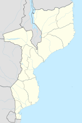
Chimoio , formerly Vila Pery , is the fifth largest city in Mozambique with 372,821 (2017) inhabitants and is located in the west of the country.
geography
Chimoio is located in the Beira Corridor , 95 kilometers east of the border with Zimbabwe , on the railway line from Beira to Harare . Chimoio is the capital of the Province of Manica and also the administrative capital of the Municipio Chimoio. The city forms an independent district.
The main attraction is the Monte Bênto / Cabeça do Velho , a rock shaped like a man's face . In the surrounding forest, monkeys and small antelopes can sometimes be seen. Not far away, on the border with Zimbabwe, is the highest mountain in Mozambique at 2,436 m , Monte Binga .
Residents
In 2007 Chimoio had 238,976 inhabitants. In 1997 it was 177,608 and in 1980 it was only 74,372. Due to the political situation in the neighboring country, the city is full of refugees. Due to the rapid population development, there is a major problem with AIDS . The percentage of infected people is estimated at an above average 25%. By 2017 the population continued to grow to 372,821 inhabitants.
history

Historically, Chimoio belonged to the Munhumutapa Empire and was called Mandingos . The place was founded in a place called Chimiala . In 1916, Mandingos was renamed Vila Pery by the Portuguese . In addition to the Portuguese, the city also had a larger population of British residents during this period. In 1969 the place was raised to a city ( Cidade ). With the independence of Mozambique in 1975 the name was changed to Chimoio. The city was affected by both the Mozambican war for independence and the civil war .
economy
The railway line serves as an export route for Zimbabwean goods to the Indian Ocean . Agricultural products from the Chimoio region also follow this route. Former farmers from Zimbabwe started new farms here after being driven from their homeland. For example, they produce paprika and tobacco for export, while the indigenous population grows on a small scale for their own use. The city's airfield is in poor condition.
Sports
The football club Textáfrica do Chimoio plays in the first Mozambican league Moçambola . The home games take place in the 5,000-seat Estádio da Soalpo stadium.
sons and daughters of the town
- Iolanda Cintura (* 1972), chemist and politician (FRELIMO)
Individual evidence
- ↑ Census 2007– 3º Recenseamento Geral da População e Habitação ( Memento from August 18, 2010 in the Internet Archive )
- ↑ a b c d e Geography University of Erlangen: Chimoio ( page no longer available , search in web archives ) Info: The link was automatically marked as defective. Please check the link according to the instructions and then remove this notice.
- ^ Aids orphans in Chimoio. In: aidsfocus.ch. Archived from the original on December 2, 2013 ; Retrieved November 7, 2014 .
- ↑ Mozambique: Provinces, Cities, Urban Settlements & Agglomerations - Population Statistics, Maps, Graphics, Weather and Web Information. Retrieved May 15, 2018 .

