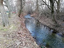
Chotina
| Chotina | ||
|
|
||
| Data | ||
| location | Slovakia | |
| River system | Danube | |
| Drain over | Nitra (river) → Waag → Danube → Black Sea | |
| source | Strážovské vrchy | |
| Source height | 780 m nm | |
| muzzle | at Topoľčany in the Nitra coordinates: 48 ° 33 ′ 20 ″ N , 18 ° 9 ′ 36 ″ E 48 ° 33 ′ 20 ″ N , 18 ° 9 ′ 36 ″ E |
|
| Mouth height | 174 m nm | |
| Height difference | 606 m | |
| Bottom slope | 21 ‰ | |
| length | 29 km | |
| Small towns | Topoľčany | |
The Chotina is a 29 kilometer long tributary of the Nitra in western Slovakia .
The Chotina rises in the Považský Inovec mountains at an altitude of 780 m near the Jakubová mountain (906 m) and flows through the Okres Bánovce nad Bebravou and the Okres Topoľčany in a southeastern direction after flowing through a small reservoir (vodná nádrž Nemečky; altitude 281, 5 m) via Nemečky , Tvrdomestice and Jacovce to its confluence with the Nitra near Topoľčany at an altitude of around 174 m.
