Nitra (river)
| Nitra | ||
|
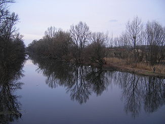
View of the Nitra near Martovce |
||
| Data | ||
| location | Slovakia | |
| River system | Danube | |
| Drain over | Waag → Danube → Black Sea | |
| source | near Kľačno in the Little Fatra 48 ° 57 ′ 43 ″ N , 18 ° 36 ′ 14 ″ E |
|
| Source height | 910 m | |
| muzzle | at Komoča in the Waag coordinates: 47 ° 57 ′ 28 " N , 18 ° 1 ′ 12" E 47 ° 57 ′ 28 " N , 18 ° 1 ′ 12" E
|
|
| length | 166 km | |
| Catchment area | 4499 km² | |
| Drain |
MQ |
24.1 m³ / s |
| Left tributaries | Handlovka , Vyčoma , Žitava | |
| Right tributaries | Nitrica , Bebrava , Chotina , Bojnianka , Radošinka | |
| Medium-sized cities | Prievidza , Partizánske , Topoľčany , Nitra , Nové Zámky | |
| Small towns | Bojnice , Nováky | |
The Nitra (German Neutra , Hungarian Nyitra ) is a 166 km long river in western Slovakia and an important left tributary of the Waag .
Its source is in the Little Fatra below the Fačkovské sedlo saddle near the village of Kľačno in Okres Prievidza . On the upper reaches it flows south through the Oberneutraer Basin (Slovak Hornonitrianska kotlina ) and flows through Nitrianske Pravno and between Prievidza and Nováky before it receives the first major tributary, the left Handlovka . On the further stretch roughly to the southwest, Nitrica comes to the right at Partizánske . There the Nitra reaches the Slovakian Danube lowlands , copies the Tribeč Mountains on the left and at Topoľčany takes on the left-hand Vyčoma and the right-hand tributaries Bebrava and Chotina . In the further course to Nitra, the river corrects its flow direction to the south, with the Bojnianka and Radošina tributaries on the right bank . In Nitra the river makes a loop between the castle hill and the Zobor and reaches the lower reaches. At Dolné Krškany, the right-hand Malá Nitra branches off from, which again reaches the main river at Bánov , while the largest tributary, the left-hand Žitava (strictly speaking only its new river course), flows into the Nitra between Šurany and Úľany nad Žitavou .
Behind Nové Zámky , the river was channeled over a length of 7 km in a laying built between 1966 and 1971 and flows into the Waag near Komoča . At the settlement of Nový Gúg, also fed by the Dlhý kanál , the Stará Nitra , which previously formed the main stream , branches off on the left . At Martovce it takes up the Žitava oxbow lake before it reaches the Waag at Lándor, a district of Komárno , which in turn flows into the Danube shortly afterwards .
See also
Web links
- Level and amount of water in the Nitra (German)
- Plán manažmentu povodňového rizika v čiastkovom povodí Váhu (PDF, 57.5 MB, Slovak, p. 91–100)


