Bánov (Slovakia)
| Bánov | ||
|---|---|---|
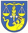
| coat of arms | map | |

|
|
|
| Basic data | ||
| State : | Slovakia | |
| Kraj : | Nitriansky kraj | |
| Okres : | Nové Zámky | |
| Region : | Dolné Považie | |
| Area : | 19.763 km² | |
| Residents : | 3,703 (Dec. 31, 2019) | |
| Population density : | 187 inhabitants per km² | |
| Height : | 121 m nm | |
| Postal code : | 941 01 | |
| Telephone code : | 0 35 | |
| Geographic location : | 48 ° 3 ' N , 18 ° 12' E | |
| License plate : | NZ | |
| Kód obce : | 503045 | |
| structure | ||
| Community type : | local community | |
| Structure of the municipality: | 2 parts of the community | |
| Administration (as of November 2018) | ||
| Mayor : | Miloš Rybár | |
| Address: | Obecný úrad Bánov Hviezdoslavova 34 94101 Bánov |
|
| Website: | www.banov.sk | |
| Statistics information on statistics.sk | ||
Bánov (Slovak 1927–1948 "Bánovská Kesa" - until 1927 "Bankesi"; Hungarian Bánkeszi ) is a municipality in western Slovakia .
location
It is located in the Danube lowlands on the banks of the Nitra and its tributary Malá Nitra , between the towns of Šurany (5 km to the north) and Nové Zámky (7 km to the south).
In addition to the main town, the municipality also includes Malá Kesa (incorporated in 1941, in Hungarian Kiskeszi ) in the western part of the municipality .
history
The place was first mentioned in 1113 as Kescu and belonged to the rule of Nitra Castle .
In the years 1241–43 and again from 1287–1288 this area suffered from Tatar invasions.
In 1498 there were 17 houses in Bánovská Kesa and 19 houses in Malá Kesa .
In the years 1554, 1596 and 1641 the Turkish wars caused great devastation. After 1685 this area was repopulated mainly by Slovaks.
In 1712 Count Alexander Károlyi bought the local property, which belonged to the family until serfdom was abolished in 1781.
A primary school was built in the village as early as 1811. In 1831 cholera broke out in the area , 102 of the 1263 inhabitants were cured and 81 died.
In 1845 a major fire destroyed two thirds of the village, another in 1857 over half. The place, which belongs to the Unter-Neutra county and the Neuhäusel district, had 1,452 Catholic residents and 76 Israelites at that time.
Between 1897 and 1900 the railway line from Neuhäusel to Šurany was built.
Until 1918 the place in Neutra County belonged to the Kingdom of Hungary , then came to the newly formed Czechoslovakia. On June 19, 1919, the Hungarian army crossed the Nitra River east of the village. Czechoslovak troops withdrew to a new defensive position west of the village and the railroad. The artillery battle lasted two days. Ultimately, 1200 Czechoslovak soldiers were able to repel the approximately 4000 Hungarian soldiers.
Bánov became part of Hungary again from 1938 to 1945 due to the First Vienna Arbitration .
During the Second World War, defenses against the Red Army were built here between Christmas 1944 and New Year 1945 . In the battle for the village in March 1945, 82 Red Army soldiers, 90 German soldiers and 10 civilians died.
Since 1993 it has been part of today's Slovakia.
Attractions
There is a Catholic Church of St. Michael the Archangel from 1842 in the village.
economy
Apart from agriculture and small businesses, there are no significant businesses.
traffic
The station is on the Nové Zámky – Zvolen railway line outside the village. There are several bus stops that are served by regional lines.
literature
- Victor Hornyansky: Geographical Lexicon of the Kingdom of Hungary and the Serbian Voivodeship with the Temescher Banate , Pest 1858
Individual evidence
- ↑ Victor Hornyansky: Geographical Dictionary of the Kingdom of Hungary and the Serbian province with the Temesh Banate. G. Heckenast, 1858, p. 24. Limited preview in the Google book search
