Kamenín
| Kamenín Kéménd |
||
|---|---|---|
| coat of arms | map | |

|
|
|
| Basic data | ||
| State : | Slovakia | |
| Kraj : | Nitriansky kraj | |
| Okres : | Nové Zámky | |
| Region : | Podunajsko | |
| Area : | 28.037 km² | |
| Residents : | 1,457 (Dec 31, 2019) | |
| Population density : | 52 inhabitants per km² | |
| Height : | 193 m nm | |
| Postal code : | 943 57 | |
| Telephone code : | 0 35 | |
| Geographic location : | 47 ° 53 ' N , 18 ° 39' E | |
| License plate : | NZ | |
| Kód obce : | 503240 | |
| structure | ||
| Community type : | local community | |
| Administration (as of November 2018) | ||
| Mayor : | Jozef Grman | |
| Address: | Obecný úrad Kamenín č. 641 943 57 Kamenín |
|
| Website: | www.kamenin.sk | |
| Statistics information on statistics.sk | ||
Kamenín (until 1948 Slovak "Kamendin"; Hungarian Kéménd ) is a municipality in the west of Slovakia with a population of 1,457 (December 31, 2019) that the Nové Zámky District , a circle of Nitriansky kraj heard.
geography
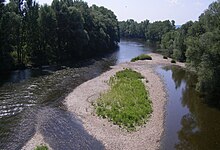
The municipality is located in the southeastern part of the Slovak Danube lowlands , within its subunit Ipeľská pahorkatina on the lower reaches of the Hron . The built-up area extends along the right bank of the river, while the higher parts are covered by loess soils on the slope of Pohronská pahorkatina . Across the river there are wooded ridges of the Ipeľská pahorkatina , which reach heights up to 267 m nm . The center of the village is at an altitude of 126 m nm and is 15 kilometers from Štúrovo , 43 kilometers from Levice and 47 kilometers from Nové Zámky .
Neighboring municipalities are Bíňa in the north, Pavlová in the northeast, Salka in the east, Kamenica nad Hronom and Malá nad Hronom in the southeast, Kamenný Most in the south, Ľubá in the southwest and Bruty in the west and northwest.
history
Kamenín is an old settlement site, with finds from the Paleolithic , further remains of a settlement of the Lengyel culture from the Neolithic , settlements of the Maďarovce and Otomány cultures of the Bronze Age , a bronze find from the Young Bronze Age and a ritual tomb from the Latène Age . In our era there were several settlements, the last one being Slavic during the Great Moravian Empire .
The current place was mentioned in writing for the first time in 1183 as Camend and at that time it belonged partly to the Gran Chapter, and partly to the Hont-Pázmány family. The second-named part passed into the possession of the Premonstratensian Order in 1219 and 1273, respectively, based in neighboring Bíňa. In the period of Turkish wars Kamenín was 1543-1683 at the edge of the Ottoman Empire , there in Sandzak Estergon. In 1560 the place was devastated by Ottoman troops. In 1699 200 people lived here, in 1715 there were 61 households and a mill. In 1787 the village had 151 houses and 884 inhabitants, in 1828 there were 173 houses and 1,039 inhabitants who were employed as farmers and winemakers.
Until 1918/1919, the place in Gran County belonged to the Kingdom of Hungary and then came to Czechoslovakia or now Slovakia. Due to the First Vienna Arbitration Award , he was again in Hungary from 1938 to 1945. In 1947, 120 Hungarian families were deported to the Czech part of Czechoslovakia according to the Beneš decrees , but 117 of them returned in October 1948.
population
According to the 2011 census, Kamenín had 1523 inhabitants, including 1179 Magyars , 250 Slovaks , 29 Roma and 13 Czechs . One resident indicated a different ethnic group and 51 residents gave no information about the ethnic group .
1232 residents committed themselves to the Roman Catholic Church, 22 residents to the Reformed Church, seven residents to the Jehovah's Witnesses, two residents each to the Orthodox Church and two residents to the Czechoslovak Hussite Church and one resident each to the Baha'itum and the Evangelical Church AB; three residents professed a different denomination. 63 inhabitants had no denomination and the denomination of 190 inhabitants was not determined.
Buildings and monuments
- Roman Catholic Church Admission of the Lord in the late Baroque style from the second third of the 18th century. The church was badly damaged towards the end of World War II, but it was renovated afterwards
- Statue of the Virgin Mary from 1883
- Memorial to the Second World War on the left bank of the Hron with a T-34 tank
- Memorial to the Hungarian War of Independence 1848–49
traffic
The Štúrovo – Levice railway , with a train station in the local area, passes through Kamenín , as does the 1st order road 76 between Štúrovo and Hronský Beňadik .
Individual evidence
- ↑ Slovenské slovníky: názvy obcí Slovenskej republiky (Majtán 1998)
- ↑ Results of the 2011 census (Slovak)
Web links
- Entry on e-obce.sk (Slovak)


