Tvrdošovce
| Tvrdošovce | ||
|---|---|---|
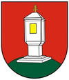
| coat of arms | map | |

|
|
|
| Basic data | ||
| State : | Slovakia | |
| Kraj : | Nitriansky kraj | |
| Okres : | Nové Zámky | |
| Region : | Dolné Považie | |
| Area : | 55.560 km² | |
| Residents : | 5,082 (Dec 31, 2019) | |
| Population density : | 91 inhabitants per km² | |
| Height : | 120 m nm | |
| Postal code : | 941 10 | |
| Telephone code : | 0 35 | |
| Geographic location : | 48 ° 6 ' N , 18 ° 4' E | |
| License plate : | NZ | |
| Kód obce : | 503614 | |
| structure | ||
| Community type : | local community | |
| Administration (as of November 2018) | ||
| Mayor : | Marián Tóth | |
| Address: | Obecný úrad Tvrdošovce Novozámocka 56 94366 Tvrdošovce |
|
| Website: | www.tvrdosovce.sk | |
| Statistics information on statistics.sk | ||
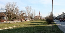
Tvrdošovce (up to 1948 in Slovak "Tardošked"; in Hungarian Tardoskedd ) is a municipality in southwestern Slovakia with 5082 inhabitants (as of December 31, 2019). It is located in the Danube Plain , about 16 km from Nové Zámky and is one of the largest non-urban communities in the country.
The place was first mentioned in writing in 1221. About 5280 inhabitants live in the village, of which 71% are of Hungarian and 27% of Slovak descent (as of 2001).
Culture
See also: List of listed objects in Tvrdošovce
Personalities
- Mikuláš Rutkovský (1940–2010), Czech sculptor and medalist
- Ladislav Móder (1945–2006), football player
- Jozef Móder (* 1947), football player
Web links
Commons : Tvrdošovce - collection of pictures, videos and audio files

