Dvory nad Žitavou
| Dvory nad Žitavou | ||
|---|---|---|
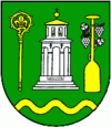
| coat of arms | map | |

|
|
|
| Basic data | ||
| State : | Slovakia | |
| Kraj : | Nitriansky kraj | |
| Okres : | Nové Zámky | |
| Region : | Dolná Nitra | |
| Area : | 63.850 km² | |
| Residents : | 5,044 (Dec 31, 2019) | |
| Population density : | 79 inhabitants per km² | |
| Height : | 121 m nm | |
| Postal code : | 941 31 | |
| Telephone code : | 0 36 | |
| Geographic location : | 48 ° 0 ' N , 18 ° 16' E | |
| License plate : | NZ | |
| Kód obce : | 503177 | |
| structure | ||
| Community type : | local community | |
| Administration (as of November 2018) | ||
| Mayor : | Branislav Becík | |
| Address: | Obecný úrad Dvory nad Žitavou Hlavné námestie 6 94131 Dvory nad Žitavou |
|
| Website: | www.dvory.sk | |
| Statistics information on statistics.sk | ||
Dvory nad Žitavou (Hungarian Udvard ) is a municipality in southwestern Slovakia .
geography
location
It is located in the Danube plain east of the river Žitava, about 8 km east of Nové Zámky at an altitude of 122 m and covers an area of 63.85 km².
population
According to the 2001 census, 72% were Hungarians, 26% Slovaks and 2% Gypsies.
history
The place was first mentioned in writing in 1075 as Villa Hudvordiensium super aquam Sitou .
From 1530 this area had to fight against Turkish invasions. After the last Turkish war, the city was almost completely devastated in 1689.
Until 1918 the municipality in Komorn County belonged to the Kingdom of Hungary (the administrative seat of the Udvard district was in Ógyalla .) And in 1919 it became part of the newly formed Czechoslovakia . She came back to Hungary for a short time from 1938 to 1945 through the First Vienna Arbitration .
Attractions
- Roman Catholic Baroque Church of St. Adalbert (1776)
- Evangelical Church (1880)
- Chapel of St. Martin (1860)
- Chapel of St. Urban (1760)
- Baroque Way of the Cross from Udvard

