Radošina
| Radošina | ||
|---|---|---|
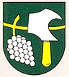
| coat of arms | map | |

|
|
|
| Basic data | ||
| State : | Slovakia | |
| Kraj : | Nitriansky kraj | |
| Okres : | Topoľčany | |
| Region : | Nitra | |
| Area : | 27.666 km² | |
| Residents : | 1,934 (Dec. 31, 2019) | |
| Population density : | 70 inhabitants per km² | |
| Height : | 216 m nm | |
| Postal code : | 956 05 | |
| Telephone code : | 0 38 | |
| Geographic location : | 48 ° 33 ' N , 17 ° 56' E | |
| License plate : | TO | |
| Kód obce : | 505421 | |
| structure | ||
| Community type : | local community | |
| Structure of the municipality: | 2 parts of the community | |
| Administration (as of November 2018) | ||
| Mayor : | Marta Kolková | |
| Address: | Obecný úrad Radošina Školská 416 95605 Radošina |
|
| Website: | www.radosina.sk | |
| Statistics information on statistics.sk | ||
Radošina (Slovak 1927–1948 "Radošiná"; German Radoschin , Hungarian Radosna ) is a municipality in western Slovakia .
location
It is located in the Danube hills at the foot of the Inowetz Mountains , on the banks of the Radošinka stream . The nearest towns are Piešťany (11 km to the northwest) and the town of Topoľčany (22 km to the east).
history
The place was first mentioned as Radusna in 1249 .
Bzince , which was incorporated in 1976, also belongs to the municipality . Orešany , which was incorporated in the same year , has been independent again since 1990.
Web links
Commons : Radošina - collection of pictures, videos and audio files

