Ludanice
| Ludanice | ||
|---|---|---|
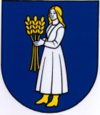
| coat of arms | map | |

|
|
|
| Basic data | ||
| State : | Slovakia | |
| Kraj : | Nitriansky kraj | |
| Okres : | Topoľčany | |
| Region : | Nitra | |
| Area : | 11.202 km² | |
| Residents : | 1,812 (Dec. 31, 2019) | |
| Population density : | 162 inhabitants per km² | |
| Height : | 160 m nm | |
| Postal code : | 956 11 | |
| Telephone code : | 0 38 | |
| Geographic location : | 48 ° 30 ' N , 18 ° 7' E | |
| License plate : | TO | |
| Kód obce : | 505048 | |
| structure | ||
| Community type : | local community | |
| Structure of the municipality: | 2 parts of the community | |
| Administration (as of November 2018) | ||
| Mayor : | Matúš Dočkalik | |
| Address: | Obecný úrad Ludanice SNP 448 955 11 Ludanice |
|
| Website: | www.obecludanice.sk | |
| Statistics information on statistics.sk | ||
Ludanice (until 1927 Slovak and "Ludany"; German Ludanitz , Hungarian Nyitraludány ) is a municipality in the west of Slovakia with a population of 1,812 (December 31, 2019) and belongs to Okres Topoľčany , a circle of Nitriansky kraj .
geography
The municipality is located in the Nitrianska pahorkatina (part of the Slovakian Danube lowlands ) on the right bank of the Nitra , in the immediate vicinity of the Tribeč Mountains . The center of the village lies at an altitude of 160 m nm and is eight kilometers south of Topoľčany .
Administratively, the municipality is divided into the municipal parts Ludanice and Mýtna Nová Ves.
history
Ludanice was first mentioned in writing in 1242 in a document of the Neutra chapter as Ludan . In the 15th century the village developed into a small town and in 1422 received the right to hold a weekly market on Mondays. The lower part belonged to a Benedictine monastery and later to the Neutra chapter. The upper part of the village was the seat of a manor and initially belonged to the Ludányi dynasty . B. Erdődy in the 17th century.
In 1892 the places Dolné Ludanice (German Unterludanitz ) and Horné Ludanice (German Oberludanitz ) merged. In 1976 the places Dvorany nad Nitrou and Mýtna Nova Ves (German Neudorf ) were incorporated, the first split off again in 1990 and since then the district Mýtna Nová Ves has separated from the main town.
population
Results after the 2001 census (1874 inhabitants):
|
By ethnicity:
|
By religion:
|
Attractions
- Roman Catholic Trinity Church from 1761
- Statue of St. Donatus from the 18th century
- Statue of St. John Nepomuk
traffic
State road 64 (Nitra – Topoľčany) runs through both districts and is located on the regional railway line Nové Zámky – Prievidza , with a train station in Ludanice and a stop in Mýtna Nová Ves.

