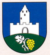
Podhradie (Topoľčany)
| Podhradie | ||
|---|---|---|
| coat of arms | map | |

|
|
|
| Basic data | ||
| State : | Slovakia | |
| Kraj : | Nitriansky kraj | |
| Okres : | Topoľčany | |
| Region : | Nitra | |
| Area : | 30.102 km² | |
| Residents : | 285 (Dec. 31, 2019) | |
| Population density : | 9 inhabitants per km² | |
| Height : | 435 m nm | |
| Postal code : | 955 01 ( Topoľčany Post Office ) | |
| Telephone code : | 0 38 | |
| Geographic location : | 48 ° 40 ' N , 18 ° 3' E | |
| License plate : | TO | |
| Kód obce : | 505340 | |
| structure | ||
| Community type : | local community | |
| Administration (as of November 2018) | ||
| Mayor : | Milan Štefkovič | |
| Address: | Obecný úrad Podhradie č. 91 955 01 Topoľčany |
|
| Website: | www.obecpodhradie.sk | |
| Statistics information on statistics.sk | ||
Podhradie (Hungarian Kővárhely - until 1907 Podhragy is a municipality in) west of Slovakia with 285 inhabitants (December 31, 2019) and belongs to Okres Topoľčany , a circle of Nitriansky kraj .
geography
The village is located on the southeast slope of the Považský Inovec Mountains by the Slivnica brook . The center of the village lies at an altitude of 435 m nm and is 17 kilometers northwest of Topoľčany .
history
Podhradie was mentioned in writing for the first time in 1245, at that time as Hornouc (modern Slovak: "Hrnovce"). After the construction of the Topoltschan Castle above the village in the late 13th century, the importance increased as it became a bailey village. This ended in the 18th century when the administration of the Topolchan domain moved to Tovarníky , which was reflected in the decline in population.
population
Results after the 2001 census (292 inhabitants):
|
By ethnicity:
|
By religion:
|
Buildings
- Topolchan Castle ruins
- Roman Catholic Church, built in 2004
- chapel


