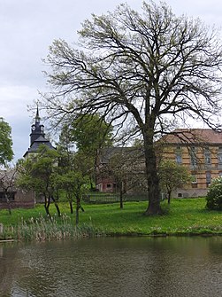
Chursdorf (Dittersdorf)
|
Chursdorf
Dittersdorf municipality
Coordinates: 50 ° 39 ′ 52 ″ N , 11 ° 51 ′ 9 ″ E
|
|
|---|---|
| Height : | 449 m above sea level NHN |
| Incorporation : | December 31 2013 |
| Postal code : | 07907 |
| Area code : | 036648 |
|
Location of Chursdorf in Dittersdorf
|
|
|
In the town
|
|
Chursdorf is a district of the municipality of Dittersdorf in the Saale-Orla district in Thuringia (Germany).
geography
Chursdorf is located in a hilly region on the northeastern edge of the Thuringian Slate Mountains / Obere Saale nature reserve . The surroundings of the villages are mainly used for agriculture, but there are also smaller forests. The soils in the slate mountains are characterized by a high proportion of fine earth and high humus content. That is why they are very fertile.
history
On June 2, 1268, the place was first mentioned in a document.
The village church with rococo paintings dates from 1770. A special feature is the decorated stalls with artistically numbered seats and the very small organ from 1753.
The agriculturally oriented villages then followed the path of agriculture in East Germany. After the reunification, they reoriented themselves and founded new associations or were reinstated.
In its meeting on December 13, 2012, the Chursdorf municipal council decided to integrate it into the Dittersdorf municipality with 4 to 1 votes. The integration was completed on December 31, 2013. The community Chursdorf was dissolved and only exists as a district. The tense financial situation of the community is given as the reason for the integration in Dittersdorf. Alternatively, the connection to Moßbach was also in the room, but this was not pursued by the local council.
In addition to the main town, the districts of Sorna and Waldhäuser also belonged to the municipality of Chursdorf .
Population development
Development of the population (December 31st each) (with Sorna and Waldhäuser):
|
|
|
|
|
- Data source: Thuringian State Office for Statistics
politics
Since the local elections on May 25, 2014, 3 residents from Chursdorf have been represented in the 6-member municipal council. According to the main statute of the municipality of Dittersdorf, there is no longer a local mayor.
traffic
Chursdorf is a few kilometers away between the trunk roads Bundesautobahn 9 and Bundesstraße 2, which run in a north-south direction . The next motorway junction is Dittersdorf .
Web links
Individual evidence
- ↑ Manfred Graf: Organization of the cooperative plant production with a high proportion of grassland in the southeast Thuringian slate mountains. Shown at the KOG "Lobenstein". 1970, (Jena, University, dissertation, 1970; typed).
- ^ Wolfgang Kahl : First mention of Thuringian towns and villages. A manual. 5th, improved and considerably enlarged edition. Rockstuhl, Bad-Langensalza 2010, ISBN 978-3-86777-202-0 , p. 52.
- ↑ Lieselotte Swietek, Wolfgang Swietek: village churches in Thuringia (= Small Thuringia library. 27). Verlagshaus Thuringia, Erfurt 1993, ISBN 3-86087-014-9 , pp. 28-29.
- ↑ according to Official Journal VG Seenplatte No. 01/2013 p. 3, accessed on January 30, 2013 [1] (PDF; 1.1 MB)
- ↑ StBA: Area changes from January 1st to December 31st, 2013
- ↑ according to Election results for the 2014 local elections Thuringia p. 186, accessed on July 10, 2014 Archive link ( Memento from July 14, 2014 in the Internet Archive ) (PDF; 7.7 MB)

