Cinq Bondes
| Cinq Bondes | ||
|
Le Grand Étang |
||
| Data | ||
| Water code | FR : L6124800 | |
| location | France , Center-Val de Loire region | |
| River system | Loire | |
| Drain over | Claise → Creuse → Vienne → Loire → Atlantic Ocean | |
| source | in the municipality of Migné 46 ° 43 ′ 15 ″ N , 1 ° 21 ′ 19 ″ E |
|
| Source height | approx. 120 m | |
| muzzle | in the municipality of Martizay in the Claise coordinates: 46 ° 48 ′ 7 ″ N , 1 ° 4 ′ 23 ″ E 46 ° 48 ′ 7 ″ N , 1 ° 4 ′ 23 ″ E |
|
| Mouth height | approx. 76 m | |
| Height difference | approx. 44 m | |
| Bottom slope | approx. 1.6 ‰ | |
| length | approx. 27 km | |
|
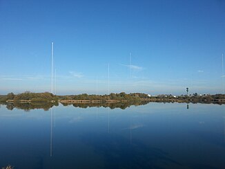
Antenna system of the French Navy near Rosnay |
||
Cinq Bondes ( pluraletantum ) is a river in France that runs in the Indre department in the Center-Val de Loire region . It rises in the Brenne Regional Nature Park , in the municipal area of Migné , generally drains in a north-westerly direction through an area rich in lakes and flows into the Claise as a left tributary after around 27 kilometers in the municipal area of Martizay .
Lakes crossed
(Order in flow direction)
- Le Grand Ménime
- Le Coudray
- Le Grand Étang
- Étang du Sault
- Étang du Blizon
Other lakes are not crossed, but artificially circumnavigated.
Places on the river
(Order in flow direction)
- Le Pied de la Gite , Migné municipality
- Migné
- Les Chaises , Migné municipality
- Le Blizon , Rosnay municipality
- Le Temple , parish of Rosnay
- Les Cinq Bondes , Lingé municipality
- Le Sablon , Martizay parish
Attractions
- Antenna system of the French Navy near Rosnay , south of the river.
Web links
Commons : Le Grand Étang - Collection of Images
Commons : antenna system of the French Navy - collection of images

