Clarksville, Virginia
| Clarksville | ||
|---|---|---|
 |
||
| Location in Virginia | ||
|
|
||
| Basic data | ||
| Foundation : | February 20, 1821 | |
| State : | United States | |
| State : | Virginia | |
| Counties : |
Mecklenburg County Halifax County |
|
| Coordinates : | 36 ° 37 ′ N , 78 ° 34 ′ W | |
| Time zone : | Eastern ( UTC − 5 / −4 ) | |
| Residents : | 1,139 (as of 2010) | |
| Population density : | 223.3 inhabitants per km 2 | |
| Area : | 5.2 km 2 (about 2 mi 2 ) of which 5.1 km 2 (about 2 mi 2 ) is land |
|
| Height : | 110 m | |
| Postal code : | 23927 | |
| Area code : | +1 434 | |
| FIPS : | 51-16992 | |
| GNIS ID : | 1492773 | |
| Website : | www.clarksvilleva.org | |
| Mayor : | Kevin S. Allgood | |
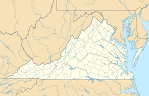
Clarksville is a municipality ( town ) in the southern US state of Virginia . The village is almost entirely in Mecklenburg County and had 1,139 inhabitants at the 2010 census .
geography
Clarksville is located on the western section of the John H. Kerr Reservoir . The village describes itself as the only city of Virginia located on an inland lake ( Virginia's Only Lakeside Town ). The majority of the municipality with the historical center is located on the south-west bank of the one and a half kilometers wide lake, a small part on a small peninsula on the opposite bank. Before the reservoir was formed, Clarksville was located at the confluence of the Dan and Roanoke Rivers . Their original course still follows the border of neighboring Halifax County today . As a result, a short section of the road bridge that connects the two parishes belongs to Halifax and not, like the rest of Clarksville, to Mecklenburg County.
The US Highway 58 bypass runs south of Clarksville , while a Virginia Southern Railroad- operated freight railroad runs through Clarksville and crosses Kerr Lake further north.
history
The area of what is now Clarksville was originally inhabited by the Occaneechee . These were driven out by the British in 1676 and Europeans settled the area. In 1818, Clarksville was - named after its founder Clarke Royster - the first town in the Mecklenburg counties the status of a Town . In the 19th century the place was a center for the trade and processing of tobacco . With the construction of the John H. Kerr Dam in the early 1950s, Clarksville changed from an agricultural community to a tourist resort.
tourism
The historic center of Clarksville was added to the National Register of Historic Places in 2002, and neighboring Occoneechee State Park is another attraction . The main attraction, however, is John H. Kerr Lake, Virginia's largest lake. Popular recreational activities include swimming, sailing, water skiing and fishing. On the third weekend in July, Clarksville hosts the Virginia Lake Festival , which is attended by up to 100,000 people.
Individual evidence
- ↑ Virginia Southern Railroad: Map of the railway line ( Memento of the original from February 8, 2015 in the Internet Archive ) Info: The archive link was automatically inserted and not yet checked. Please check the original and archive link according to the instructions and then remove this notice.
- ↑ Clarksville Lake Country Chamber of Commerce: History of Clarksville (English)
- ↑ nationalregisterofhistoricplaces.com: Mecklenburg County - Historic Districts (English)
- ↑ virginia.org: Virginia Lake Festival (English)
