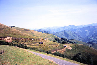
Col Bagargui
| Col Bagargui | |||
|---|---|---|---|
|
Col Bagargui, upper part of the east ramp |
|||
| Compass direction | west | east | |
| Pass height | 1327 m | ||
| Department | Pyrénées-Atlantiques , France | ||
| Valley locations | Esterençuby | Larrau | |
| expansion | D 19 | ||
| Mountains | Pyrenees | ||
| profile | |||
| Mountain scoring | 2 | 1 | |
| Ø pitch | 4.7% (327 m / 7.0 km) | 8% (821 m / 10.2 km) | |
| map | |||
|
|
|||
| Coordinates | 43 ° 2 '17 " N , 1 ° 1' 36" W | ||
The Col Bagargui (also Col d'Iraty , Basque Bagargi , also: Bagargiak in the local Basque dialect of Zuberoa ) is a 1327 meter high mountain pass in the western Pyrenees . It forms the transition between the former provinces of Soule and Lower Navarra in the French Basque Country . The name "Bagargiak" means "light beeches " and refers to the Iraty forest .
Routing
Two routes lead from Saint-Jean-Pied-de-Port in the west to Col Bagargui: The D 18, which can be seen as the main route, leads north via Mendive and the 1135 m high Col de Burdincurutcheta , further south the D 301 comes via Esterençuby and the Col passes d'Arthaburu (1150 m) and Col de Sourzay (1140 m). Both routes meet at the small Iraty reservoir. The shared road D 19 overcomes a good 320 meters in altitude over a length of 7 km. At the top of the pass, which is indicated on the sign as Col d'Iraty , is the Les Chalets d'Iraty holiday complex and a restaurant with a panoramic terrace. The eastern ramp from Larrau is much more challenging . It initially follows the narrow valley of a stream for almost 5 km, and then climbs abruptly. Over a length of 6 km, it overcomes almost 600 meters in altitude, only the last 1.5 km are a little flatter. The steepest kilometer has an average gradient of an impressive 11.5%.
Tour de France
The Col Bagargui has been on the Tour de France program three times so far . In 1986 and 1987 it was driven on from the west side and was only an increase in the second category. The first rider at the summit was the French Ronan Pensec , later sixth in the overall standings. The 2003 Tour de France first climbed the eastern ramp as a first category mountain classification. First on the pass was the American Tyler Hamilton , who then also won the 16th stage in Bayonne .
Individual evidence
- ↑ IGN (Ed.): Carte de randonné No. 1346 ET. Forêt d'Iraty - Pic d'Orhy . Explanatory text by André Pées


