
Columbretes
| Columbretes | ||
|---|---|---|
 |
||
| Waters | Balearic Sea , Mediterranean Sea | |
| Geographical location | 39 ° 53 ' N , 0 ° 41' E | |
|
||
| Number of islands | 25th | |
| Main island | Columbrete Grande (Grosso) | |
| Total land area | 0.19 km² | |
| Residents | uninhabited | |
 |
||

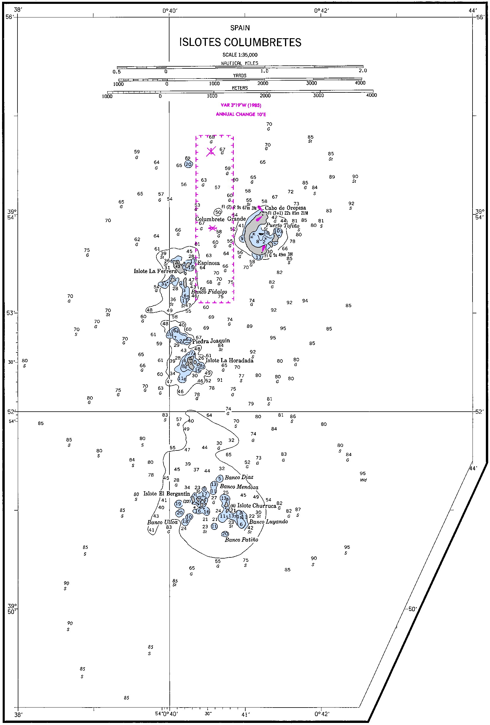
The Islas Columbretes ( Valencian Illes Columbretes ) are a Spanish archipelago that consists of four volcanic archipelagos that are grouped around the main islands of Columbrete Grande , Ferrera , Forrada and Bergantín Carallot . In total, there are around 25 individual islands and cliffs . They are located in the Mediterranean Sea , more precisely in the Balearic Sea , around 55 km east of the city center of Castellón de la Plana , the capital of the province of Castellón to which they belong.
geography
The islands are protected as a nature reserve and cover an area of 19 hectares , of which 13.33 hectares are taken by the largest island, the Columbrete Grande . The highest point of the archipelago on the Columbrete Grande is 67 m above sea level.
The name of the islands comes from Greek and Roman sailors who recorded them on their nautical charts. At first they were named Ophiusa or Colubraria because of the numerous snakes that were found there. For centuries, the islands served as the seat and haven of pirates and smugglers. In the 19th century, the islands were freed from snakes with fire and a lighthouse was erected at the highest point, which was operated by lighthouse keepers until automation in 1975. For a time, the islands were uninhabited until 1988, the Government of the Autonomous Community of Valencia hired park rangers, were declared the islands a nature park.
The islands are a popular diving spot. However, you need a permit to enter the islands, as they have a unique flora and fauna worthy of protection. Despite the classification as a nature park, fishing is allowed in the waters around the islands.
Main islands and submarine banks , grouped by archipelago:
| El Grupo de l'Illa Grossa (14.30 ha ) |
El Grupo de la Ferrera (1.95 ha) |
El Grupo de la Horadada (2.21 ha) |
El Grupo de Bergantín o Galiano (0.49 ha) |
|---|---|---|---|
|
Columbrete Grande (Grosso) (13.33 ha ) |
La Ferrera (Malaspina) (1.53 ha) |
Piedra Joaquín (20 m²) |
El Bergantin (Galiano) (0.414 ha) |


geomorphology
The volcanic field of the Columbretes Islands sits on the outer edge of the Ebro continental shelf on a 60 meter high, 12 kilometer long and 4 kilometer wide submarine bulge that culminates at a depth of 80 meters. Its core is likely to be built up from Paleozoic metamorphic rocks that form an eyrie on the left-shifting Western European rift system .
It is around 10 kilometers to the shelf edge further east in 160 meters of water. It falls into the Valencia trough at a little over 5 ° to a depth of 1200 meters . A huge mass flow up to 20 kilometers wide has loosened at its edge, covering almost the entire edge of the shelf and coming to a stop after 15 kilometers at a depth of 1,150 meters.
geology
Volcanism began in the Columbretes Islands in the late Oligocene and was initially of a calcareous nature. From the Middle Miocene onwards , there was a fundamental change to alkaline volcanic rocks, mainly basanites , which built up the island of Columbrete Grande in four cycles separated by discordances between 1.0 and 0.3 million years ago . The archipelagos in the south consist of phonolites . The islands are all affected by severe marine erosion. However, they are surrounded by numerous submarine volcanic structures, which deform or penetrate the Holocene deck sediments. These structures should therefore be very young and no older than 13,000 years.
Individual evidence
- ↑ Islas Columbretes. In: Global Volcanism Program. Smithsonian Institution, National Museum of Natural History, accessed January 23, 2020 .
- ↑ Columbretes. In the cresta del volcan. ( Memento of the original from September 27, 2013 in the Internet Archive ) Info: The archive link was inserted automatically and has not yet been checked. Please check the original and archive link according to the instructions and then remove this notice.
- ↑ Cañada-Guerrero, F .: Contribución al estudio geolgóico de la plataforma continental submarina en el area de las Islas Columbretes . In: Boletin Geol. Minero . LXXXII-II, 1971, pp. 152-156 .
- ^ Casas, D. et al .: Recent mass-movement processes on the Ebro continental slope (NW Mediterranean) . In: Marine and Petroleum Geology . tape 20 , 203, pp. 445-457 , doi : 10.1016 / S0264-8172 (03) 00078-3 .