Cordillera Azanaques
| Cordillera Azanaques | |
|---|---|
|
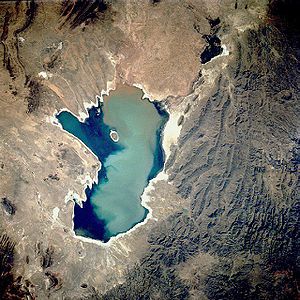
The Poopó lake with the mountain group to the east |
|
|
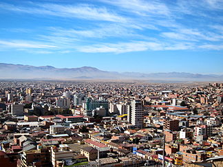
Oruro with the mountain range in the background |
|
| Highest peak | Negro Pabellón ( 5400 m ) |
| location | Oruro / Potosí department border , Bolivia |
| part of | Cordillera Central |
| Coordinates | 18 ° 22 ′ S , 66 ° 54 ′ W |
The Cordillera Azanaques (also: Cordillera de Azanaques ) is a section of the Cordillera Central in the Andes high mountains of Bolivia .
The Cordillera Azanaques extends for about 150 km in north-south direction from 17 ° 40 'to 19 ° 25' south latitude , from Oruro to Lake Poopó , and is bounded to the west by the Río Desaguadero . Its highest peaks are Negro Pabellón ( 5400 m ), El Toro ( 5180 m , in some cases a height of 5810 m is also given) and Cerro Azanaques ( 5102 m ). The Cordillera de los Frailes connects to the south .
The rocky mountains of Azanaques are rich in minerals such as tin , silver , lead , antimony , zinc and bismuth .
Web links
- Definición de Azanaques, Cordillera de los. Retrieved March 13, 2014 (Spanish).

