Creel
| Creel | ||
|---|---|---|
|
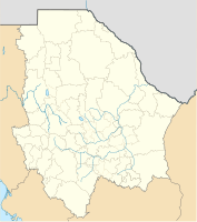
Coordinates: 27 ° 45 ′ N , 107 ° 38 ′ W Creel on the map of Chihuahua
|
||
| Basic data | ||
| Country | Mexico | |
| State | Chihuahua | |
| Municipio | Bocoyna | |
| City foundation | 1907 | |
| Residents | 5026 (2010) | |
| Detailed data | ||
| surface | 3.68 km 2 | |
| Population density | 1,366 inhabitants / km 2 | |
| height | 2345 m | |
| Post Code | 33200 | |
| Creel - the townscape | ||
Creel is a small town with about 5,000 inhabitants in the municipality (municipio) Bocoyna in the northwest of the Mexican state Chihuahua . The place was recognized as Pueblo Mágico in 2007 .
Location and climate
Creel is located above the Barranca del Cobre ("Copper Gorge") at an altitude of about 2345 m in the Sierra Tarahumara , a sub-area of the Sierra Madre Occidental , about 260 km (driving distance) southwest of Chihuahua City and 10 km southwest of Bocoyna right on the CHEPE railway line , which also runs through El Fuerte . The climate is temperate to warm because of the altitude; Rain (approx. 735 mm / year) falls almost exclusively in the summer half-year.
population
| year | 2000 | 2005 | 2010 |
| Residents | 4,613 | 5,338 | 5,026 |
The vast majority of the population is of Indian descent; Mestizos are clearly in the minority.
economy
Agriculture (cultivation of maize , beans, tomatoes , chilli, etc.) still plays the dominant role in the surrounding villages . With the construction of the railway line from Chihuahua to Los Mochis on the Pacific , the formerly small mountain village experienced a significant economic and tourist upgrade.
history
The former Indian settlement was named after Enrique Creel Cuilty (1854-1931), a Chihuahua's governor in 1907-1910.
Attractions
- The small town offers little in all of interest, but the overall atmosphere is definitely worth seeing.
- The panoramic view of the gorges of the copper canyon is of great tourist importance.
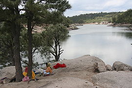
- Hotels and other local tour operators offer various trips and hikes in the scenic surroundings, e.g. B. to about 8.5 km southeast of Arareco Lake.
Web links
- Creel, tourism site - photos + information
- Creel etc., tourism site - photos + information
- Creel and surroundings - video


