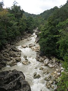
Cuha
| Cuha | ||
|
The Cuha flows through the center of the municipality of Viqueque (administrative boundaries from 2003-2015) |
||
| Data | ||
| location | East Timor | |
| River system | Cuha | |
| origin | In the southeast of the sucos Uabubo 8 ° 43 ′ 19 ″ S , 126 ° 24 ′ 26 ″ E |
|
| muzzle | in the Timor Sea coordinates: 8 ° 57 ′ 14 " S , 126 ° 23 ′ 19" E 8 ° 57 ′ 14 " S , 126 ° 23 ′ 19" E
|
|
| Left tributaries | Lee, mouth: 8 ° 54 '8 " S , 126 ° 23' 33" O Lago Lagotua; aperture: 8 ° 50 '57 " S , 126 ° 24' 47" O |
|
| Right tributaries | Metaquena; aperture: 8 ° 48 '45 " S , 126 ° 22' 10" O Sacaria; aperture: 8 ° 48 '10 " S , 126 ° 21' 47" O Caimalulo; aperture: 8 ° 44 '47 " S , 126 ° 24 '56 " E. |
|
| Small towns | Viqueque | |
|
View of the town of Viqueque with the Cuha on the right |
||
The Cuha ( Portuguese Ribeira Cuha or Rio Cuha, tetum Mota Cuha ) is an East Timorese river in the municipality of Viqueque , in the southeast of the island of Timor .
course
The Cuha rises in the east of the southeast of the Sucos Uabubo (administrative office Ossu ). At the border with Uaguia the Caimalulo flows into the Cuha . Uaguia is crossed and then forms the border river between the Sucos Ossorua and Loi-Huno in the southeast and Ossu de Cima in the northwest. After the confluence of the Sacaria , the Cuha swings from the south-westerly direction of the river to the south, then the Metaquena meets it. All three previous tributaries also originate in Ossu de Cima. Before the Cuha crosses the west of Loi-Huno.
The Cuha then enters the administrative office of Viqueque with its Suco Caraubalo , crosses it and forms part of the border with Suco Uma Uain Craic . Here the Cuha crosses the municipal capital Viqueque . Then the Cuha follows the border between the sucos Uma Uain Craic and Uma Quic until it flows into the Timor Sea. Halfway there, the leeward flows into the Cuha from the east . The Lee arises from the Lago Lagotua in Caraubalo and follows the eastern border between Uma Uain Craic and Caraubalo until it crosses shortly before its confluence with the Cuha Uma Uain Craic.
In the dry season between May and November the water level of the Cuha drops sharply, while in the rainy season the river threatens the area with flooding, especially in the lower reaches, south of the city of Viqueque.
Web links
Individual evidence
- ↑ Timor-Leste GIS Portal ( Memento from June 30, 2007 in the Internet Archive )
- ↑ Maps of the Ossu and Viqueque Administrative Offices, Ministry of State Administration, 2015.
- ↑ UN Office for the Coordination of Humanitarian Affairs: Flood Hazard Map, Timor-Leste , November 19, 2007


