Cunnamulla
| Cunnamulla | |||||||
|---|---|---|---|---|---|---|---|
 Cunnamulla War Memorial |
|||||||
|
|||||||
|
|||||||
|
|||||||
|
|||||||
|
|
|||||||
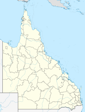
Cunnamulla is a city with 1,022 inhabitants in the southwest of the Australian state of Queensland . It is 750 kilometers west of Brisbane and 200 kilometers south of Charleville, Queensland on the Warrego River . The small town is at the junction of the Mitchell Highway and Balonne Highway . Cunnamulla is the administrative seat of the 47,617 km² administrative area (LGA) Paroo Shire Council .
The name Cunnamulla means something like elongated piece of water or large water hole in the language of the Aborigines .
history
The first European was the explorer Thomas Mitchel who passed this area in 1846 in search of a way to the Gulf of Carpentaria . The first settlements appeared about 10 years later, but it was only after the explorer William Landsborough came to Cunnamulla in 1862 that the settlement began to develop properly. In 1868 the city was surveyed and a courthouse was built in the same year. In the 1880s, numerous farmers moved to the city, the fertile plains and the reliable water supply from the Warrego River made the area ideal for sheep farming. Today around 2 million sheep graze in this area.
The first coach from Bourke reached the small town in 1879, and in 1899 it was connected to the railroad .
traffic
About 8 kilometers northwest of Cunnamulla is the city's small regional airport, served by MacAir Airlines .
climate
|
Average monthly temperatures and rainfall for CUNNAMULLA POST OFFICE - Altitude: 189 m from 1907 to 2011
Source:
|
|||||||||||||||||||||||||||||||||||||||||||||||||||||||||||||||||||||||||||||||||||||||||||||||||||||||||
Web links
Individual evidence
- ↑ Australian Bureau of Statistics : Cunnamulla (L) ( English ) In: 2016 Census QuickStats . June 27, 2017. Retrieved April 13, 2020.
- ↑ a b c Cunnamulla - Queensland - Australia - Travel (English) . In: Sydney Morning Herald , Fairfax Media, February 8, 2004. Retrieved November 17, 2011.
- ^ Cunnamulla - Gateway to the Paroo Shire , http://www.paroo.info . Retrieved November 17, 2011.
- ↑ Climate statistics for Australian locations (CUNNAMULLA POST OFFICE) ( English ) Australian Government - Bureau of Meteorologie . Retrieved June 6, 2009.
