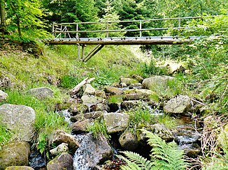
Dürreych
| Dürreych | ||
| Data | ||
| Water code | DE : 238422 | |
| location |
Black Forest
|
|
| River system | Rhine | |
| Drain over | Eyach → Enz → Neckar → Rhine → North Sea | |
| Source height | 930 m above sea level NN | |
| confluence | with the Brotenaubach to the Eyach Coordinates: 48 ° 45 ′ 25 ″ N , 8 ° 29 ′ 3 ″ E 48 ° 45 ′ 25 ″ N , 8 ° 29 ′ 3 ″ E |
|
| Mouth height | 570 m above sea level NN | |
| Height difference | 360 m | |
| Bottom slope | 64 ‰ | |
| length | 5.6 km | |
The Dürreych is a stream in the northern Black Forest on the Reichental district of the city of Gernsbach in the Rastatt district .
The Dürreych - probably from Dürre Eyach , because this creek in the upper reaches sometimes dries up - is the left source river of the Eyach . Its uppermost tributary comes from the Kleiserstein (930 m above sea level). It carries water continuously from the still water source (after 1.8 km) and joins the Brotenaubach to the Eyach after a 5.6 km run and 360 m difference in altitude . It runs in a narrow Kerbtal in the Middle Buntsandstein with Ice Age kar formations on the north to east facing valley slopes. The Rotliegend comes to light in the mouth area.
The Dürreychtal is uninhabited with the exception of the forester's house Dürreych . This living space is a part of Gernsbach.
literature
- Markus C. Casper: The identification of hydrological processes in the catchment area of the Dürreychbach (Northern Black Forest). Dissertation. University of Karlsruhe (TH), 2002 ( online ).
- Guido Waldenmeyer: Runoff formation and regionalization in a catchment area used for forestry (Dürreychtal, Northern Black Forest). Dissertation. University of Karlsruhe (TH), 2003 ( online ).
Web links
- Dürreych project - research work in the hydrological test area Dürreychbachtal 1996–2001
Individual evidence
- ^ Friedrich Huttenlocher , Hansjörg Dongus : Geographical land survey: The natural spatial units on sheet 170 Stuttgart. Federal Institute for Regional Studies, Bad Godesberg 1949, revised 1967. → Online map (PDF; 4.0 MB)
- ^ Dürreych (living space) at the Baden-Württemberg State Archives, accessed on July 21, 2013
