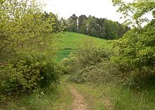
Dütberg

The Dütberg is 122 m above sea level. NN high, partly wooded hills of the Lower Saxon mountainous region . The elevation classified as a geotope in the central area is located in Lower Saxony between the districts of Rohrsen and Afferde near Hameln in the Hameln-Pyrmont district . The B 217 passes to the north and the Hamel River runs parallel to it .
description
The Dütberg occupies an area of 10–12 hectares ; with its foothills it is about 40 ha. The elevation has several peaks , which consist of ice-age gravel and sand deposits and between which loess is deposited. The Dütberg was formed as a small-scale glacial deposit in the Drenthe stage of the Saale Ice Age , the ice masses of which had their southernmost extent in the Hameln area. After the ice melted, the elevation remained as a terminal moraine . From a geoscientific point of view, it is of great importance, so that it is classified as a geotope on 15 hectares.
Due to the undulating meadows on the north side, which are used as pastureland , the Dütberg creates an alpine-like impression. It has a special faunistic and floristic importance, as it serves as a habitat for rare and endangered animal and plant species. The bird species red-backed shrike and nightingale breed here . The elevation shows various, closely interlinked biotopes , such as moderately moist and dry meadows , sandy grasslands rich in bases , ruderal meadows on the nutrient-poor meltwater deposits, areas with no vegetation, deeply rutted paths, as well as hedges , bushes and forests . The plants include the wild carrot , tansy and various types of clover . The vegetation attracts various species of wild bees , such as the six-spotted ram .
The Dütberg has been designated as a landscape protection area since 1952 and thus fulfills the requirements for a nature reserve . The process that has been planned since 2012 to designate a 25-hectare area of the Dütberg as a nature reserve, which has in some cases met with criticism from local residents, is to begin in 2017.
history
In the 18th century, during the Seven Years' War , cannons were set up on the Dütberg that fired at Rohrsen. The place was then cremated by shelling and fire.
After the Second World War , the central area of the Dütberg was used by pioneer units of the British Rhine Army stationed in Hameln as a military training area on around 14.5 hectares. This part of the Dütberg was not accessible to the public as a military restricted area . After the withdrawal of the British armed forces from Hameln in 2012, military use was ended. Since then, access has been possible again on a network of trails, including the Weserberglandweg over the Dütberg. Since around 2015 there have been specific plans to build a bypass road south of Hameln, the route of which should lead past the Dütberg to the south. Construction is expected to start in 2021.
See also
- List of geotopes in the Hameln-Pyrmont district
- List of landscape protection areas in the Hameln-Pyrmont district
Web links
- Düth. Nature reserve with important biotopes at hameln.de
- Photos from the British training area on the Dütberg near the British Army in Hameln
- Description of the Dütberg in the context of the Ice Age Weser
Individual evidence
- ↑ Lars Lindhorst: Why the Düth should get a different status in Dewezet on February 8, 2017
- ↑ Rohrsen. In the loops of the Weser
- ↑ Marc Fisser: Hameln southern bypass - start of construction in four years? in Dewezet on January 26, 2017
Coordinates: 52 ° 6 ' N , 9 ° 25' E

