Dangelsdorf (Görzke)
|
Dangelsdorf
Görzke municipality
Coordinates: 52 ° 10 ′ 15 ″ N , 12 ° 24 ′ 33 ″ E
|
|
|---|---|
| Height : | 88 m |
| Postal code : | 14828 |
| Area code : | 033847 |
|
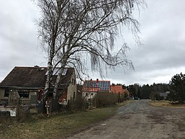
Benkener Strasse in Dangelsdorf
|
|
Dangelsdorf is a district of the municipality of Görzke in the Potsdam-Mittelmark district in Brandenburg .
Geographical location
Dangelsdorf is east of the community center. In the north is Dahlen , a district of the municipality of Gräben. This is followed in a clockwise direction by Werbig (to Bad Belzig ) and the two districts of Benken and Schlamau in the municipality of Wiesenburg / Mark , followed by the Görzk district of Börnecke . Most of the district is forested or used for agriculture.
history
The place was laid out in the 16th century as a preliminary work for one of the three Görzker manors. Until the 20th century, farmers ran a sheep farm , which was transferred to a VEB during the GDR era .
Sights and culture, transport
- About 1.5 km to the north is the Dangelsdorf desert with the ruins of a stone church .
- The place is the seat of the Buddhist group Fläming.
- The main road 95 runs through the town in a west-east direction. In a southerly direction there is a connection to Börnecke with the Benkener Weg. The bus route 593 of the VBB connects the place with Görzke and Bad Belzig.
Web links
Commons : Dangelsdorf - Collection of images, videos and audio files
- Dangelsdorf on the website of the municipality of Görzke , accessed on March 26, 2018.
literature
- Council of the community of Görzke with the support of the society for local history of the district Belzig: News from eight centuries of Görzk history , Märkische Volksstimme, Potsdam, 1989
