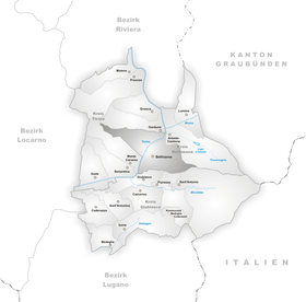
Daro TI
| Daro | |
|---|---|
| State : |
|
| Canton : |
|
| District : | Bellinzona district |
| Circle : | Bellinzona district |
| Municipality : | Bellinzona |
| Postal code : | 6503 |
| Coordinates : | 722.99 thousand / 117207 |
| Residents: | 1859 (1900) |
| Website: | www.bellinzona.ch |
| map | |
Daro is a fraction of the political community Bellinzona , county Bellinzona , district of Bellinzona , in the Swiss canton of Ticino .
geography
The village is at an altitude of 267 m above sea level. M. on a terrace at the western foot of Monte Arbino and a series of vine-planted slopes, 500 m east of Bellinzona.
history
The village was first mentioned in 1173 under the then name de Dali . Prehistoric graves were discovered here.
Daro was attached to the municipality of Bellinzona in 1907/08, along with Artore and Pedemonte. Ecclesiastically, it forms a parish separate from Bellinzona in 1631.
population
| Population development | |||||
|---|---|---|---|---|---|
| year | 1599 | 1698 | 1801 | 1836 | 1900 |
| Residents | 130 | 212 | 295 | 483 | 1859 |
Attractions
- Parish church of San Quirico first mentioned in 1173.
literature
- Giuseppe Chiesi: Daro. In: Historical Lexicon of Switzerland . March 31, 2004 , accessed January 8, 2020 .
- Simona Martinoli u. a .: Guida d'arte della Svizzera italiana. Edited by the Society for Swiss Art History . Edizioni Casagrande, Bellinzona 2007, ISBN 978-88-7713-482-0 , pp. 21-40.
- Celestino Trezzini : Daro. In: Historisch-Biographisches Lexikon der Schweiz , Volume 2: Daehler - Eglolf. Attinger, Neuenburg 1924, p. 670 ( digitized version ).
Web links
- Data from the municipality of Bellinzona
- Office for Statistics of the Canton of Ticino: Bellinzona
- History of the local community of Daro in (Italian) patriziato-di-daro.ch (accessed on: May 7, 2016.)
- Daro on elexikon.ch
Individual evidence
- ^ Giuseppe Chiesi: Daro. In: Historical Lexicon of Switzerland . March 15, 2005 .
- ^ Simona Martinoli and others: Guida d'arte della Svizzera italiana. Published by the Society for Swiss Art History , Edizioni Casagrande, Bellinzona 2007, ISBN 978-88-7713-482-0 , pp. 21, 40.
