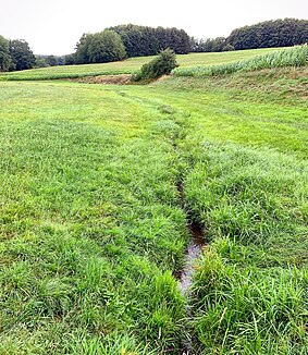
Dernbach (Elbbach)
| Dernbach | ||
| Data | ||
| Water code | DE : 2587616 | |
| location | Westerwaldkreis , Rhineland-Palatinate ( Germany ) | |
| River system | Rhine | |
| Drain over | Elbbach → Lahn → Rhine → North Sea | |
| source | in the Westerwald near Kölbingen 50 ° 33 ′ 39 ″ N , 7 ° 55 ′ 48 ″ E |
|
| Source height | 443 m above sea level NHN | |
| muzzle | near Kaden in den Elbbach Coordinates: 50 ° 32 '39 " N , 7 ° 55' 5" E 50 ° 32 '39 " N , 7 ° 55' 5" E |
|
| Mouth height | 357 m above sea level NHN | |
| Height difference | 86 m | |
| Bottom slope | 28 ‰ | |
| length | 3.1 km | |
| Catchment area | 3.497 km² | |
The Dernbach is a 3.1 km long, eastern and left tributary of the Elbbach in the Westerwald . It flows in the Rhineland-Palatinate Westerwaldkreis .
course
The Dernbach arises north of Kölbingen on the southern edge of the Geisenwald on the southern slope of an unnamed mountain ( 496.2 m above sea level ) from two spring branches, both of which arise at a height of about 443 m and are each around 160 m long.
After the source branch union, the Dernbach initially flows in a south-southeast direction through a meadow landscape. Shortly after reaching Kölbingen, it flows through the village, piped underground, and reappears at its southern edge. Its course is lined here by trees, hedges and bushes. About 600 m below Kölbingen it changes direction and is now moving in gentle curves towards the west. In doing so, it passes a forest, only to flow along the northern edge of it shortly afterwards.
Southeast of Kaden , the Dernbach flows into the Lahn tributary Elbbach, which comes from the north, between several ponds at around 357 m, near the Neumühle .
See also
Individual evidence
- ↑ a b c d Map service of the landscape information system of the Rhineland-Palatinate nature conservation administration (LANIS map) ( notes )
- ↑ a b c GeoExplorer of the Rhineland-Palatinate Water Management Authority ( information )
