
Diamantina Fracture Zone

The Diamantina Fracture Zone (literally translated Diamantina Fracture Zone ) is a stratum in the southeast Indian basin of the Indian Ocean up to 7100 m deep . Falsely it is sometimes called Diamantinagraben ( English Diamantina trench called).
geography


According to General Bathymetric Chart of the Oceans (GEBCO) the actual, about 550 km long starts Diamantina Fracture Zone in the west ( 33 ° 57 ' S , 101 ° 27' O ) on the south-eastern end of the Broken Ridge and extends to the east ( 36 ° 12 ′ S , 106 ° 38 ′ E ) to the south of the Perth Basin to the southern edge of the Naturaliste Plateau . North of it is the eastern end ( 32 ° 40 ' S , 102 ° 30' O ) of the Diamantina Escarpment whose western end ( 31 ° 0 ' S , 90 ° 0' O ) on Ninety East Ridge located. The mostly 10 °, but partly 35 ° steep slope of the escarpment drops over 5100 m from the Broken Ridge (634 m) south of the Wharton Basin to the south to the bottom of the Diamantina Trench (5800 m), which geomorphologically because of its flat bottom as Is to be designated Trogtal . In some cases, eastern foothills south of Australia are added to the Diamantina Fracture Zone (according to GEBCO Diamantina (East) Zone , 37 ° 30 ′ S , 128 ° 0 ′ E ), which means that it extends into the Australian marine reserve South-west Corner Marine Park . The overall structure is between 160 and 180 km wide and 2500, 2600 or 3400 km long, depending on the author.
The Diamantina Fracture Zone is located at the point where the formation and expansion of the Southeast Indian Ridge , now more than 1,000 km to the south , which separates the Antarctic and Australian plates , began. The age is estimated at 43.8 to 108 million years . The area has a very uneven topography with a very strong relief, which consists of several hundred kilometers long deep sea ridges and gullies with deep faults and several presumably extinct volcanoes . The Hadal zone below 6500 m is about 2430 km².
It is not a fracture zone in the sense of plate tectonics , but a layer between two oceanic plateaus . The zone was probably created during the ocean floor spreading or crust thinning in the separation between Australia and the Antarctic. In the 1960s, a theory of blade displacement was still partly assumed.
Research history

The Diamantina Zone was discovered by the three- master Vema and the research vessel Argo in 1960, and shortly afterwards the Australian naval vessel HMAS Diamantina investigated the region from which it got its name. It identified the Diamantina Deep ( 35 ° 0 ' S , 104 ° 0' O ) with a water depth m of the 8047th This information was recorded as the lowest point in the Indian Ocean in the GEBCO Undersea Feature Names Gazetteer and mentioned in specialist literature. In 2004, the research vessel and icebreaker Nathaniel B. Palmer collected more up-to-date data, and parts of the zone were also measured in the search for Malaysia Airlines Flight 370 , which disappeared in 2014 . In 2018, the deepest point of the zone was recalculated using several bathymetric data sets and given as 7099 m ( 34 ° 48 ′ S , 102 ° 34 ′ E ).
In 2019, an expedition led by Victor Vescovo , who wanted to reach the deepest points of all oceans with the submersible Limiting Factor, examined the area with a lander and a fan-shaped echo sounder . Mapping revealed a maximum depth of the Diamantina Fracture Zone of 7019 m ± 17 m in the Dordrecht Depth ( 33 ° 38 ′ S , 101 ° 21 ′ E ). On the basis of the GEBCO _2014 global bathymetry dataset and the Global Multi-Resolution Topography Synthesis , Stewart and Jamieson calculated the depth of the Dordrecht Depression at 7090 to 7100 m, but the location had to be corrected compared to the calculation from 2018, compared to the sounding in 2019 it was in a second, northern part of the Dordrecht Depression ( 33 ° 25 ′ S , 101 ° 29 ′ E ). At the point of the Diamantina Deep identified in 1960, the water depth is only 5300 m. Since then, the Dordrecht Deep has been considered the deepest part of the Diamantina Fracture Zone, and the Java Trench at 7290 m as the deepest part of the Indian Ocean.
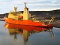
Research vessel Nathaniel B. Palmer

Pressure drop with submersible limiting factor


Web links
Individual evidence
- ↑ a b c d e f g Heather A. Stewart, Alan J. Jamieson: The five deeps: The location and depth of the deepest place in each of the world's oceans . In: Earth-Science Reviews 197, October 2019, 102896, doi: 10.1016 / j.earscirev.2019.102896 .
- ↑ Marc Munschy, Jerome Dyment, Marie Odile Boulanger, Daniel Boulanger, Jean Daniel Tissot, Roland Schlich, Yair Rotstein, Millard F. Coffin: Breakup and Seafloor Spreading between the Kerguelen Plateau – Labuan Basin and the Broken Ridge – Diamantina Zone . In: SW Wise, Jr., R. Schlich et al. (Ed.): 1992 Proceedings of the Ocean Drilling Program, Scientific Results , Vol. 12051.
- ^ A b c d Undersea Feature Names Gazetteer , General Bathymetric Chart of the Oceans . Search term "Diamantina"; Diamantina Fracture Zone , Diamantina Escarpment and Diamantina (East) Zone , Marine Gazetteer Placedetails, www.marineregions.org. Retrieved May 12, 2020.
- ↑ a b c Kim Picard, Brendan P. Brooke, Peter T. Harris, Paulus JW Siwabessy, Millard F. Coffin, Maggie Tran, Michele Spinoccia, Jonathan Weales, Miles Macmillan-Lawler, Jonah Sullivan: Malaysia Airlines flight MH370 search data reveal geomorphology and seafloor processes in the remote southeast Indian Ocean . In: Marine Geology 395, January 2018, pp. 301–319, doi: 10.1016 / j.margeo.2017.10.014 .
- ^ South-west Corner Marine Park , parksaustralia.gov.au, accessed May 13, 2020.
- ^ A b c Dennis E. Hayes, John R. Conolly: Morphology of the Southeast Indian Coast . In: Dennis E. Hayes (Ed.): Antarctica Oceanology II: The Australian-New Zealand Sector, Volume 19 , 1978, doi: 10.1029 / AR019p0125 .
- ^ A b Douglas F. Williams, Bruce H. Corliss: The South Australian Continental Margin and the Australian-Antarctic Sector of the Southern Ocean In: AEM Nairn: The Ocean Basins and Margins: The Indian Ocean. Springer 2013, p. 566, ISBN 978-1-4615-8038-6 .
- ↑ a b A. A. Bulychev, DA Gilod, EP Dubinin: Structure of the lithosphere of the northeastern part of the Indian Ocean gemäß to results of two-dimensional structural density modeling . In: Geotectonics 50, 2016, pp. 257-275, doi: 10.1134 / S0016852116030043 .
- ^ Joanne M. Whittaker, Simon E. Williams, R. Dietmar Müller: Revised tectonic evolution of the Eastern Indian Ocean . In: Geochemistry, Geophysics, Geosystems , Volume 14, No. 6, June 2013, pp. 1891–1909, doi: 10.1002 / ggge.20120 .
- ↑ a b J.-Y. Royer, DT Sandwell: Evolution of the eastern Indian Ocean since the Late Cretaceous: Constraints from Geosat altimetry . In: Journal of Geophysical Research : Solid Earth 94 (B10), 1989, pp. 13755-13782, doi: 10.1029 / jb094ib10p13755 .
- ↑ a b c Heather A. Stewart, Alan J. Jamieson: Habitat heterogeneity of hadal trenches: considerations and implications for future studies . In: Progress in Oceanography 161, 2018, pp. 47-65, doi: 10.1016 / j.pocean.2018.01.007 .
- ↑ Samurdhika Rathnayake, Robert Tenzer, Mehdi Eshagh, Martin Pitoňák: Gravity Maps of the Lithospheric Structure Beneath the Indian Ocean . In: Surveys in Geophysics 40, 2019, pp. 1055-1093, doi: 10.1007 / s10712-019-09564-6 .
- ^ Fabienne Chatin, Ursula Robert, Raymond Montigny, Hubert Whitechurch: La zone Diamantine (océan India oriental), témoin de la séparation entre l'Australie et l'Antarctique: arguments pétrologiques et géochimiques . In: Comptes rendus de l'Académie des sciences - Series IIA - Earth and Planetary Science , 326 (12), 1998, pp. 839-845, doi: 10.1016 / s1251-8050 (98) 80022-0 .
- ↑ John C. Mutter, Steven C. Cande: The early opening between Broken Ridge and Kerguelen Plateau . In: Earth and Planetary Science Letters 65, 1983, pp. 369-376, doi: 10.1016 / 0012-821X (83) 90174-7 .
- ↑ John C. Mutter, Kerry A. Hegany, Steven C. Cande, Jeffrey K. Weissel: Breakup between Australia and Antarctica, a brief review in the light of new data . In: Tectonophysics 114, 1985, pp. 255-279, doi: 10.1016 / 0040-1951 (85) 90016-2 .
- ^ BC Heezen, Marie Tharp: Tectonic Fabric of the Atlantic and Indian Oceans and Continental Drift . In: Philosophical Transactions of the Royal Society , Series A, Mathematical and Physical Sciences , Volume 258, No. 1088, October 28, 1965, pp. 90-106, JSTOR 73335 .
- ↑ Peter Nunan: HMAS Diamantina . 2nd Edition, Boolarong Press, Salisbury 2017. Quoted from a review by Alan Powell in: The Great Circle , Volume 40, No. 1, 2018, pp. 136-138, edited by the Australian Association for Maritime History, JSTOR 26783793 .
- ↑ Peter Kenshole: 'A Country Girt by Sea': An Overview of Australian Maritime Exploration and Policy Drivers . In: Stuart Pearson, Jane L. Holloway, Richard Thackway (Eds.): Australian Contributions to Strategic and Military Geography . Springer, 2018, ISBN 978-3-319-73407-1 , p. 39, doi: 10.1007 / 978-3-319-73408-8_3 .
- ↑ Vittorio Barale: The Asian Marginal Seas and Enclosed: An Overview. In: V. Barale, M. Gade (Ed.): Remote Sensing of the Asian Seas . Springer, Cham 2018, pp. 3–38, doi: 10.1007 / 978-3-319-94067-0_1 .
- ↑ Heather Stewart, Alan Jamieson, Cassie Bongiovanni: Exploring the Deepest Points on Planet Earth: Report on The Five Deeps Expedition . www.hydro-international.com, June 18, 2019.
- ↑ Ben Taub, Paolo Pellegrin: Thirty-six Thousand Feet Under the Sea: The explorers who set one of the last meaningful records on earth . In: The New Yorker , May 10, 2020.