Dillenberg (Oberreifenberg)
| Dillenberg | ||
|---|---|---|
|
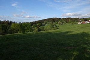
Dillenberg above the houses of the Siegfriedsiedlung on the eastern outskirts of Oberreifenberg. |
||
| height | 682.4 m above sea level NHN | |
| location | near Oberreifenberg ; Hochtaunuskreis , Hessen ( Germany ) | |
| Mountains | Taunus | |
| Dominance | 0.4 km → Großer Feldberg | |
| Notch height | 10 m ↓ Mosigweg | |
| Coordinates | 50 ° 14 '49 " N , 8 ° 27' 4" E | |
|
|
||
The Dillenberg is a mountain in the Taunus with 682.4 m above sea level. NHN . It is located in the Oberreifenberg district of the Schmitten community in the Hochtaunus district in Hesse .
geography
location
The wooded Dillenberg is a crooked spur from the northern slope of the Großer Feldberg , the highest mountain in the Taunus , and is 1.7 km away from its summit. The Siegfried settlement of Oberreifenberg begins at the western edge of the forest, 150 m away . To the east, the Dillenberg falls into the valley of the Krötenbach , the water of which flows further north to the Lauterbach and finally in the center of Schmitten from the right to the Weil . To the west, the landscape drops through the Schmittgrund, in which the Weilborn is a secondary source and the Heckenrainweiher at the end of the valley, to the Weil.
Natural allocation
The Dillenberg belongs in the natural spatial main unit group Taunus (No. 30) and in the main unit Eastern Hintertaunus (302) to the subunit Horse Head Taunus (302.6).
See also
Individual evidence
- ↑ a b Map services of the Federal Agency for Nature Conservation ( information )
- ↑ Brigitte Schwenzer: Geographical land survey: The natural space units on sheet 139 Frankfurt a. M. Federal Institute for Regional Studies, Bad Godesberg 1967. → Online map (PDF; 4.9 MB)

