Dixie National Forest
|
Dixie National Forest
IUCN Category VI - Protected Area with Sustainable use of Natural Resources |
||
|
in the Red Canyon |
||
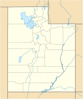
| location | Utah , United States | |
| surface | 7,644.94 km² | |
| Geographical location | 38 ° 2 ' N , 111 ° 38' W | |
|
|
||
| Sea level | from 853 m to 3451 m | |
| Setup date | September 25, 1905 | |
The Dixie National Forest is a National Forest in the US -Bundesstaat Utah . With an area of nearly two million acres (8,000 km²), it is the largest national forest in Utah. It consists of several large contiguous forest areas owned by the US federal government. Like all national forests , it is primarily used for forestry and pasture management , but it also has a significant leisure function.
geography
The forest area extends in southern Utah over the border between the Great Basin and the Colorado Plateau at elevations between 853 m (2800 feet ) at St. George and 3451 m (11,322 feet) on Boulder Mountain . The Dixie National Forest is located in Garfield , Washington , Iron , Kane , Wayne, and Piute Counties . The area consists of four individual sections that extend roughly in a west-east direction. The forest areas are located on the heights of the partly deeply rugged, partly gently rounded mountain ranges. The valleys are too dry for forests and are therefore not part of the national forest.
Four wilderness areas are embedded in the National Forest , the Ashdown Gorge Wilderness , the Box-Death Hollow Wilderness , the Cottonwood Forest Wilderness and the Pine Valley Mountain Wilderness with a total area of about 347 km². In them, as in all wilderness areas, only movement on foot or on horses is permitted. All mechanical means of transport, including mountain bikes and other bicycles, are prohibited.
fauna
The flora ranges from desert-like plants in the warm, lower elevations to pine and juniper bushes in the middle elevations to aspen and conifer forests in the higher elevations, where much of the precipitation falls as snow.
history
The first white man to set foot in what is now the National Forest was the Spanish missionary and explorer Silvestre Vélez de Escalante , looking for a route to California . He described the area in 1776.
Many of the Mormon settlers around St. George came from the southern United States in 1851 . Because this area reminded them of the southern states because of the temperatures, the settlers called it Utah's Dixie , which is what the current name is based on. The Dixie Forest Reserve was established in 1905 and declared a National Forest in 1907.
use
The US Forest Service slogan for the national forests is "Land of many uses". National forests are forest and pasture areas owned and managed by the Federal Government. In the Dixie National Forest, an average of around 24,000 cubic meters (10 million board feet ) of wood is felled each year, and pasture land has been leased to ranchers in all four areas since the national forest was founded .
In addition, leisure and recreational use has been on a large scale since the 1970s. Hundreds of kilometers of hiking trails are maintained in the Dixie National Forest, there are 25 campsites and the Forest Service rents cabins to visitors. In addition, hikers can camp anywhere in the area. Hunting is permitted in three of the four areas.
Web links
Individual evidence
- ↑ a b c Dixie National Forest - About Us , fs.usda.gov, accessed on July 9, 2019.
- ↑ Wilderness , fs.usda.gov, accessed July 9, 2019 (English)
- ↑ a b History of the Dixie National Forest , fs.usda.gov, accessed on July 9, 2019 (English)
- ↑ The National Forests of the United States , foresthistory.org, accessed July 9, 2019 (PDF)
- ↑ USFS: Dixie Land Management
- ↑ USFS: Dixie Resource Management
- ↑ USFS: Dixie Camping & Cabins
- ↑ USFS: Dixie Hunting


