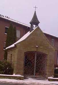
Dröper
Dröper is a settlement in the Oesede district of the independent town of Georgsmarienhütte in Lower Saxony .
geography
Geographical location
Dröper is located in the so-called Osnabrücker Land between the city of Osnabrück in the north and the Teutoburg Forest in the south. The entire Osnabrück region is of a purely Westphalian culture and geography . The Westphalian influence reached historically far along the Ems and in Lower Saxony far into the heath and extended into the Oldenburg and Hanoverian regions.
Dröper is also on the banks of the Düte and the Breenbach in the Osnabrücker Land in the middle of the " Osnabrücker Hügelland ". In the south it is bounded by the Musenberg, which is already part of the Teutoburg Forest (whose old name is Osning). Dröper thus borders directly on the Teutoburg Forest Nature Park . The altitude on the Düte is 64 m above sea level. NHN . The highest point of the settlement is on the Musenberg at 190 m .
geology
Geologically speaking, Dröper resembles the Osnabrück area (see there). The existing soils are very loamy or cohesive and are therefore quite suitable for arable farming.
climate
Dröper is located in the warm, temperate climate zone. Westerly and northwest winds are decisive, which can bring cool weather in summer and mild rainy weather in winter. The weather situation is therefore inconsistent.
Neighboring communities
clockwise starting from north:
history
Emergence
Many of the old farming communities in the vicinity of Osnabrück carry Saxon local and field names and confirm the fact that the region in the early Middle Ages came into view of history. However, documents did not appear until the end of the millennium. Dröper (formerly Throp, Thorp) was certainly settled and made arable before. Originally the area consisted of dense forest. Beeches and oaks grew. Ash and alder grew in the lowlands and birch trees on sandy soil.
Dröper was first mentioned by name in 1118. The settlement was given the name Throp at that time. The name Droops Hof still reminds of the old terminology. At that time the wood court was in session in Dröper, during which a contract was concluded between the march comrades of Oesede and the Iburg monastery regarding the monastery’s rights to use wood and mast in the Oeseder Mark.
History in years
- 37,000 BC Chr. First appearance of people in this room
- 4,000 BC Chr. An ax from chert Local Oesede testifies to the presence of humans during the Neolithic in this room
- 1118 Wooden court in Dröper
- 1182 Wehrenbrecht, Werner and Gerbrecht von Dröper as witnesses at the Count's Court near the Hohen Linde
- 1489 Sale of a plot of land in Dröper by the Oeseder march comrades for the construction of the church, approved by the Bishop of Osnabrück
- 1714 Expansion of the Osnabrück – Iburg traffic artery by Bishop Karl von Lothringen with simultaneous relocation of the Dütebrücke from Dröper to Oesede
- 1885 "Villa Brinke" comes to the rural community Dröper
- 1900 Establishment of a “commercial advanced training school” in Dröper
- 1912 Establishment of a two-class school in Dröper
- 1918 Merger of the village of Oesede with Dröper, purchase of the Wortmannschen Hof for the establishment of a community center
Population development
- 1512 - 44 taxpayers (taxpayers)
- 1601 - 97 taxpayers
- 1634 - 49 taxpayers (taxpayers)
- 1772 - 198 inhabitants
- 1858 - 442 inhabitants
- 1885 - 614 inhabitants
- 1905 - 774 inhabitants
Source: City history according to Rudolf Richter
Infrastructure and economy
societies
- Petrels Dröper (soccer)
- FC after work (football)
- FC Zaufen
traffic
The main artery of Dröper is Wellendorfer Straße. Dröper owes its good transport links to the regional center of Osnabrück to it and the adjacent B 51 . Not least for this reason, Dröper is the first choice for many people wanting to settle in the greater Osnabrück area: 15 minutes drive (by car) from here to the center of Osnabrück is a value that cannot be reached from some parts of Osnabrück itself. The bus connection to Osnabrück is also attractive with an average cycle time of 30 minutes and travel times of around 20 minutes.
Settlements
Dröper has grown strongly since the mid-1990s: The Averwettersfeld building area was settled from 1995 (160 residential units), and at the beginning of 2009 the Dröper West building area , 60 building lots, was added. The settlement area Dröper was contoured more clearly through the settlement.
Infrastructure
The infrastructural development (small power plant with combined heat and power ) is also exemplary . The supply is ensured by a bakery with a small additional range, and there is also a drinks market that has been family-owned for decades. Disposal (sewer system, green waste collection point) is also secured. There is also a good internet connection.
Culture
The Dröper citizens' initiative is a loose association of Dröperans who want to make Dröper a little more “ livable ” through their activities and projects . The initiative maintains the local playground.
The annually recurring flea market near the town center is also of cultural sociological value, as it offers an insight into the disposable components of neighboring households.
Web links
- Dröper School: [1]
- [2] as well as rural customs [3]
- Citizens' initiative Dröper
Coordinates: 52 ° 12 ' N , 8 ° 5' E
