Jarylhatsch
| Jarylhatsch | ||
|---|---|---|
| Waters | Karkinitska Bay , Black Sea | |
| Geographical location | 46 ° 2 ′ N , 32 ° 57 ′ E | |
|
|
||
| length | 42 km | |
| width | 4.8 km | |
| surface | 56.05 km² | |
| Residents | uninhabited | |
Dscharylhatsch ( Ukrainian Джарилгач ; Russian Джарылгач / Dscharylgatsch ; translated from Turkish "burned wood") is an uninhabited Ukrainian island in the Black Sea .
With 5605 hectares, it is the largest island in the Ukraine and the Black Sea and partly a national park .
In the time of Herodotus , Jarylhatsch and its neighboring island Tendra were called Achilles ' racetrack .
geography
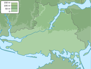
The island is located in the Karkinitska Bay of the Black Sea, protected under the Ramsar Convention , between the north-west coast of the Crimean peninsula and the mainland coast of Kherson Oblast . It forms the southern boundary of Jarylhatsch Bay , on the opposite bank of which the city of Skadovsk is located.
Administratively, Jarylhatsch belongs to Skadovsk Raion in Kherson Oblast. Two kilometers from the start of the spit there is a spa and urban-type settlement Lasurne ( Лазурне ).
The island has an area of 56 km² (5605 ha ) and the total length from west to east is about 42 km. The maximum length of the actual island is about 23 km from west to east and the width from north to south is a maximum of 4.6 km. The length of the spit , which almost extends to the mainland, is about 19 km with a width of 30 m to 430 m. The highest point is 2.8 m above the shore of the island. The average height is 0.4 to 0.5 m above sea level.
climate
The island has a temperate, dry climate. The average annual rainfall is less than 400 mm. In winter the average temperature is −1 to −2 ° C, in summer it is +23 ° C.
Flora and fauna
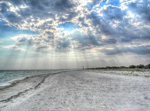
Jarylhach has clean sandy beaches and mineral springs. There is a freshwater spring in the center, and more than four hundred small salt lakes are scattered across the island. The unique flora and fauna are still well preserved. It is a habitat for wild boars, deer, mouflons, horses as well as numerous gulls and cormorants. By the presidential decree № 1045/2009 dated December 11, 2009, part of the island is national natural park.
Web links
- Website about the island at zatyshny.com.ua (English)
- Articles about the island (Russian)
- brama.com (English)
- Photo Gallery of dzharylhach (English)
- World Database on Protected Areas - Dzharilgats'kiy State Zakaznik (English)
- Map and description of the Ramsar area (Ukrainian)
Individual evidence
- ↑ Description of the Ramsar area (Ukrainian; PDF; 133 kB)
- ↑ Herodotus 4, 55 and 4, 76.
- ↑ Herodotus , Histories . German complete edition, translated by A. Horneffer, re-edited and explained by HW Haussig , with an introduction by Walter F. Otto . Kröner, Stuttgart 1971, p. 691.
- ↑ Dzharylgach Iceland
- ↑ Decree for the creation of the national park (Ukrainian)
- ↑ Page on the National Parks of Ukraine (Ukrainian)


