
Eßmühler Bach
| Eßmühler Bach | ||
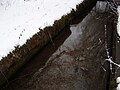
 Eßmühler Bach in winter |
||
| Data | ||
| location | Administrative community Dirlewang , Unterallgäu district , Bavaria | |
| River system | Danube | |
| Drain over | Westernach → Mindel → Danube → Black Sea | |
| source | in Bittenau ( Unteregg municipality ) 47 ° 57 ′ 24 ″ N , 10 ° 27 ′ 13 ″ E |
|
| Source height | 711 m above sea level NN | |
| muzzle | near Köngetried (municipality of Apfeltrach ) in the Katzbruierbach Coordinates: 47 ° 58 ′ 30 ″ N , 10 ° 27 ′ 32 ″ E 47 ° 58 ′ 30 ″ N , 10 ° 27 ′ 32 ″ E |
|
| Mouth height | 671 m above sea level NN | |
| Height difference | 40 m | |
| Bottom slope | 20 ‰ | |
| length | 2 km | |
| Communities | Unteregg, apple trach | |
| Residents in the catchment area | almost 100 | |
The Eßmühler Bach is an approximately two kilometer long brook that flows into the Westernach , which is also called Katzbruierbach in this area . Via the Westernach the brook is an indirect tributary of the Mindel . The Eßmühler Bach rises in the hamlet of Bittenau and after a kilometer flows through the hamlet of Eßmühle . Both places belong to the Unteregg municipality in the Unterallgäu district . The brook flows into the Katzbruierbach, which is called Westernach from then on , at 671 meters above sea level . The difference in height between the source and the mouth is 40 meters. Important buildings along the Eßmühler Bach are the mill in Eßmühle and the grotto in Köngetried .
gallery

Eßmühler Bach in Eßmühle

Grotto on the course of the stream
Artificially created part of the stream


