EN4 (Mozambique)
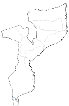
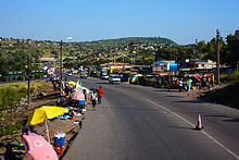
The national road EN4 ( Portuguese : Estrada Nacional Número Quatro ) is a trunk road in the south of Mozambique . It runs from the South African-Mozambican border to the capital Maputo and is mainly used for freight traffic to and from the port areas in Maputo and Matola . On the South African side, the N4 , which is subject to toll on some sections, connects .
history
Mozambique and South Africa signed a bilateral framework agreement in 1996, according to which the traffic connections between Witbank and Maputo were to be expanded to increase the efficiency of heavy goods traffic . The joint projects have been summarized under the term Maputo Corridor . The establishment of toll sections was also agreed. For a long time, the road conditions were particularly bad because the civil war in Mozambique had left considerable damage to the entire country and its road system. It had to be removed in connection with the expansion of the EN4 landmines .
In 1997 the Trans Africa Concession (TRAC) was awarded the contract to modernize and expand the transport infrastructure in this corridor zone. The construction work included the construction of two new border crossings , on the South African side the Lebombo -Grenzstation ( Lebombo Border Post ) and Mozambican side, the Ressano-Garcia -Grenzstation ( Ressano Garcia border post ), a. This shortened the clearance times for freight traffic at the border and customs authorities . The TRAC license is valid for 30 years.
Both South Africa and Mozambique charge fees for using the EN4. The toll station of Moambo ( Moambo toll plaza ) opened in March 2000. Another exists in since January 2001 Matola ( Maputo toll plaza called).
The construction activities on EN4 were ended in 2004. The road connections to the port of Maputo / Matola, including the port entrance zones, were modernized by 2006. The capacity now allows freight transport with 56-ton trucks.
meaning
The EN4 is very important for the import and export traffic of South Africa, as it represents a section of the shortest land route between a seaport and the industrial conurbations in the provinces of Mpumalanga , Limpopo and Gauteng . Large quantities of goods come from the City Deep Container Terminal in Johannesburg . In addition, economic goods are transported to and from Botswana , Zimbabwe and Eswatini . The EN4 is a section of the Trans-Kalahari-Highway transport route .
Route
The route of the EN4 begins on the border with South Africa , east of the city of Komatipoort , where it picks up or transfers traffic from the N4 national road from the neighboring country. After the Mozambican border station, the road turns south and runs in a wide arc south of the small town of Moamba . The old route of a route that only runs as a country road to Moamba is no longer used. South of Moamba, the EN4 crosses the R251, which runs towards Boane . On the outskirts of Matola, it touches the industrial zones around Maputo. There is an internal branch to the port area of Matola. The last section of the EN4 road runs through built-up areas and, not far from the south-western outskirts of the capital, meets the port zone in the Maputo Bay near Matola and the EN2 national road with the central junction with the EN1 national road leading to the north of the country .
Individual evidence
- ↑ Trans African Concessions: Welcome to TRAC N4 Toll Route . on www.tracn4.co.za (English)
- ^ Maputo Corridor Logistics Initiative: Border Posts along the MDC . on www.mcli.co.za ( Memento of the original from July 3, 2013 in the Internet Archive ) Info: The archive link was inserted automatically and has not yet been checked. Please check the original and archive link according to the instructions and then remove this notice. (English)
- ↑ Nó de Tchumene pronto em Março e “Circular” prestes a terminar: Nó de Tchumene pronto em Março e “Circular” prestes a terminar | O País. In: O País. July 24, 2016. Retrieved July 25, 2016 (Portuguese).
- ↑ USAID: Maputo Corridor. A Transport Logistics Diagnostic Tool Study. Maputo Corridor Transport Logistics System . 2007, PDF document p. 11. at www.sarpn.org (English)
- ^ Trans African Concessions: Route map . on www.tracn4.co.za ( Memento of the original from April 30, 2014 in the Internet Archive ) Info: The archive link was inserted automatically and has not yet been checked. Please check the original and archive link according to the instructions and then remove this notice. (English)


