Eagle River (Colorado River)
| Eagle River | ||
|
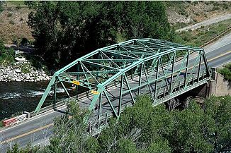
Bridge at Eagle over the Eagle River |
||
| Data | ||
| Water code | US : 174007 | |
| location | Eagle County in Colorado (USA) | |
| River system | Colorado River | |
| Drain over | Colorado River → Pacific Ocean | |
| Confluence of | East Fork and South Fork Eagle River 39 ° 25 ′ 18 ″ N , 106 ° 18 ′ 49 ″ W. |
|
| Source height | 2833 m | |
| muzzle | at Dotsero in the Colorado River Coordinates: 39 ° 38 '45 " N , 107 ° 3' 28" W 39 ° 38 '45 " N , 107 ° 3' 28" W. |
|
| Mouth height | 1866 m | |
| Height difference | 967 m | |
| Bottom slope | approx. 9.7 ‰ | |
| length | approx. 100 km | |
| Catchment area | 2450 km² | |
| Drain |
MQ |
16.3 m³ / s |
| Left tributaries | Homestake Creek , Gypsum Creek | |
| Right tributaries | Gore Creek | |
| Small towns | Avon , Eagle , Gypsum | |
| Communities | Red Cliff , Minturn , Wolcott , Eagle-Vail , Dotsero | |
The Eagle River ( English for " Adler is -flow"), a left tributary of the Colorado River in the central part of the State of Colorado .
The Eagle River arises at the confluence of its two headwaters, East Fork and South Fork Eagle River . It initially flows in a predominantly north-northwest direction through the Rocky Mountains . He passes the places Red Cliff and Minturn . The US Highway 24 follows the river. At Wolcott the river turns west. Here the Gore Creek flows into the Eagle River from the east. Now the two highways Interstate 70 and US Highway 6 run along the Eagle River. It follows the place Eagle-Vail and the small towns of Avon , Eagle and Gypsum . At Dotsero , the Colorado River, coming from the north, meets the Eagle River and absorbs its water. The Eagle River has a length of about 100 km. Its river course is entirely within Eagle County . In the upper reaches, the Eagle River flows through part of the White River National Forest . The river drains an area of 2450 km². Its discharge in dry years is only 5.7 m³ / s in late summer. During the spring floods , its discharge values are 200 m³ / s.
From the Eagle Mine , which was closed in the 1980s - located between Redcliff and Minaker - water contaminated with heavy metals ended up in the Eagle River.
Individual evidence
- ↑ a b USGS Gage # 09070000 on the Eagle River below Gypsum, CO (PDF; 101 kB)
- ^ Colorado Cleanup Sites. EPA
