Rohrwiesenbach (Haggraben)
| Rohrwiesenbach | ||
|
The Rohrwiesenbach at Häuserackerhof |
||
| Data | ||
| location |
Spessart
|
|
| River system | Rhine | |
| Drain over | Haggraben → Forchbach → Main → Rhine → North Sea | |
| origin | The confluence of the glans ditch , Ratzgraben and root digging | |
| Source height | 132 m above sea level NHN at the confluence | |
| muzzle | North-west of Häuserackerhof in den Haggraben Coordinates: 50 ° 2 '1 " N , 9 ° 3' 46" E 50 ° 2 '1 " N , 9 ° 3' 46" E |
|
| Mouth height | 111 m above sea level NHN | |
| Height difference | 21 m | |
| Bottom slope | 24 ‰ | |
| length | 870 m from the confluence 2.5 km with Ratzgraben |
|
| Catchment area | 1.2 km² | |
|
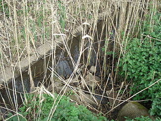
The Rohrwiesenbach (front right) flows into the Haggraben (from front left to back right) |
||
The Rohrwiesenbach is a right tributary of the Haggraben in the district of Aschaffenburg in the Bavarian Spessart . It arises from the confluence of the glans ditch , Ratzgraben and root ditch east of Häuserackerhof . The Ratzgraben is the longest and most water-rich source stream in the Rohrwiesenbach.
course
The Rohrwies stream passes after the confluence of the headwaters a small pond , leaves the forest and flows, in digging the road to Hörstein , for Häuserackerhof . There its water seeps away on dry days. The Rohrwiesenbach flows into the Haggraben to the north-west of the Häuserackerhof .
See also
Web links
Commons : Rohrwiesenbach - Collection of images, videos and audio files
Individual evidence
- ↑ a b c d e BayernAtlas of the Bavarian State Government ( notes )
- ↑ According to the map from Google Maps the complete stream name
- ↑ According to the Topographical Atlas of the Kingdom of Bavaria on this side of the Rhine, sheet: 9 Dettingen from 1850 the complete name of the brook
- ↑ According to the BayernViewer of the Bavarian State Government ( information ) the complete Bach name

