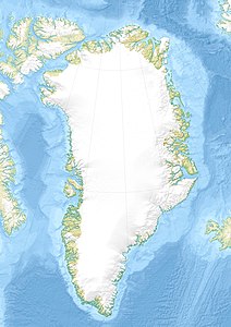
Ella Ø
| Ella Ø | ||
|---|---|---|
| Southwest coast of Ella Island | ||
| Waters | Baffin Bay | |
| Geographical location | 72 ° 51 ′ N , 25 ° 3 ′ W | |
|
|
||
| length | 19.5 km | |
| width | 15.2 km | |
| surface | 143.6 km² | |
| Highest elevation | Bastions 1367 m |
|
| Residents | 4th (2012) <1 inh / km² |
|
| Satellite image of Ella Island (enclosed by ice at top left) and Traill Island | ||
Ella Ø ( German Ella Island ) is an island off the east coast of Greenland . Administratively it belongs to the non-parish area of the Northeast Greenland National Park .
geography
The island lies in the inner part of the Kong Oscar Fjord and at the western end of the Kempefjord . It is separated from mainland Greenland by narrow straits : in the south-west by Narhvalsund from Lyell-Land and in the north-west by Suess-Land . The smaller islands Maria Ø and Ruth Ø are in front of the northern tip of Ella Island. In the east and northeast are the large islands of Traill Ø , Geographical Society Ø and Ymer Ø , between which the Vegasund and Sofiasund lead to the open Greenland Sea .
Ella Ø has roughly the shape of a triangle. The three "corners" are Bastionpynt in the west, Richardpynt in the northeast and Cape Harry in the southeast. The highest point is Bastionen at 1367 m. Its western flank drops 1200 m almost vertically into the sea. At the Solitærbugt, protected by Cape Oswald, in the north-west and on the east coast, there are also flat areas. The island reaches its greatest extent between Bastionpynt and Richardpynt with 19.5 km. Their area is 143.6 km².
geology
Ella Ø consists of Caledonian folded sediments from the Cambrian and Ordovician , overlaid with deposits from the middle Devonian . The Ella Island Formation from the early Cambrian is named after her, which forms an approximately 80 m thick sequence of coarse-grained limestone with portions of slate .
history
The island was discovered in 1899 by an expedition of the Swedish polar explorer Alfred Gabriel Nathorst and named by him after his wife Amy Rafaela (Ella) Windahl (1858-1936). He gave the names of his daughters to the nearby islands of Maria Ø and Ruth Ø. Nathorst found fossils from the Cambrian here - for the first time in East Greenland .
In 1931, the participants in a three-year expedition led by the Danish geologist Lauge Koch set up one of their two wintering stations on Solitærbugt on the north coast of Ella Island. This remained the most important station for scientific work in East Greenland until the 1950s. In 1933 Charles Lindbergh flew over Greenland and landed on Ella Ø on August 4th. During the Second World War, the research station was a base of the sled patrol Northeast Greenland (Danish: Nordøstgrønlands Slædepatrulje ) of the Danish armed forces and was used by the United States Army as a military base at Bluie East Four . From 1947 to 1954, the station was permanently inhabited by participants in Koch's annual expeditions. 1950–1951 the sled patrol had its headquarters here before it was moved to Daneborg . The station is still used by the Sirius patrol and, since 2003, by Nanok, an organization that takes care of the maintenance of the hunting lodges in East Greenland.
The Ella Island Meteorite
In August 1971, the American geologist Keene Swett found the only known meteorite in East Greenland on Ella Island. It is an L6 chondrite , the ten fragments of which have a combined mass of 7.5 kg. It consists mainly of olivine and Ca-pyroxene and has a density of 3.53 g / cm³.
Individual evidence
- ↑ Ella Ø , Den grønlandske Havnelods, accessed on August 18, 2018 (Danish).
- ↑ UNEP Islands (English)
- ↑ a b Kaare Lund Rasmussen, Minik Rosing : Ella Ø in Den Store Danske Encyklopædi (Danish)
- ↑ Anthony K. Higgins: Exploration history and place names of northern East Greenland (= Geological Survey of Denmark and Greenland Bulletin 21, 2010), ISBN 978-87-7871-292-9 (English). P. 163 ( PDF ; 12.3 MB).
- ↑ a b Ella Ø station
- ↑ Anthony K. Higgins: Exploration history and place names of northern East Greenland (= Geological Survey of Denmark and Greenland Bulletin 21, 2010), ISBN 978-87-7871-292-9 (English), p. 45 ( PDF ; 12 , 3 MB).
- ^ Entry in the Meteoritical Bulletin Database
- ^ JH Carman, GR McCormick: The Ella Island, Greenland, chondrite . In: Meteoritics . Volume 10, 1975, pp. 1-8.


