Elmaubach
|
Elmaubach Elmaubach |
||
|
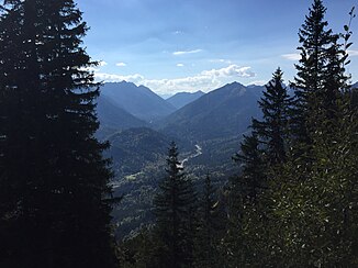
Course of the Elmaubach through the Ammer Mountains |
||
| Data | ||
| location | Garmisch-Partenkirchen district , Bavaria | |
| River system | Amperes | |
| Drain over | Linder → Ammer → Amper → Isar → Danube → Black Sea | |
| source | Hirschbichel, Ammergau Alps 47 ° 34 ′ 14 ″ N , 10 ° 59 ′ 47 ″ E |
|
| Source height | approx. 1275 m above sea level NHN m | |
| muzzle |
Linder coordinates: 47 ° 32 '40 " N , 10 ° 58' 55" E 47 ° 32 '40 " N , 10 ° 58' 55" E |
|
| Mouth height | 894 m above sea level NHN | |
| Height difference | approx. 381 m
|
|
|
The Elmaubach flows into the Linder |
||
The Elmaubach is a river in the Ammer Mountains in Upper Bavaria , which in the Linder flows and thus to the river system of Amper belongs.
geography
course
The source area of the brook lies on the western foothills of the Hirschbichel, a mountain in the Kramer group of the Ammergau Alps , at an altitude of about 1275 m above sea level. NHN . From there it flows mainly north through the Elmautal, which separates the Kramer group and the Kreuzspitz group, into the Graswang valley .
At an altitude of about 960 m above sea level. NHN joins the from the valley between Kuchelberg and Frieder Berg coming Kuchelbach , the largest tributary of the Elmaubachs, from the left in this. From here on, the stream bed mostly forms a wide gravel bed, called Elmaugries.
On the valley floor of the Graswang valley, the Elmaubach crosses under the state road 2060 running through the valley to the north and flows shortly thereafter at an altitude of 894 m above sea level. NHN in the Linder .
Tributaries
- Enninglahne (right)
- Karlegraben (left)
- Kiengraben (right)
- Partition wall trench (right)
- Kuchelbach (left)
- Kieneckgraben (right)
Web links
Individual evidence
- ↑ Source of the Elmaubach in the Bavaria Atlas
- ↑ mouth of Elmaubachs in Atlas Bayern

