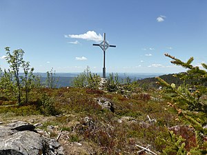
Gentian (Bavarian Forest)
| gentian | ||
|---|---|---|
|
Summit of the gentian |
||
| height | 1285 m above sea level NHN | |
| location | Border district Cham and district Regen , Bavaria ( Germany ) | |
| Mountains | Bavarian forest | |
| Coordinates | 49 ° 7 ′ 25 ″ N , 13 ° 5 ′ 0 ″ E | |
|
|
||
| rock | Gneiss | |
The gentian is a 1285 m above sea level. NHN high mountain of the Bavarian Forest , which rises in the ridge northwest of the Arber . Its summit lies on the border of the districts of Cham and Regen with the communities of Lohberg in the north and Drachselsried in the west-southwest.
The long-distance hiking trail E6 leads over its bare, flat summit from Arber to Kaitersberg , at the highest point there is a stamping point and a summit book. On a hike over the Arberkamm, views of the Zellertal and the Lamer Winkel open up again and again . The Enzian is rarely climbed as an independent hike.
Individual evidence
Web links
Commons : Enzian - Collection of Images

