Lamer angle
The Lamer Winkel is a region in the northern Bavarian Forest between the mountains Hoher Bogen , Osser , Arber and Kaitersberg . Politically, this area belongs to the district of Cham in the administrative district of Upper Palatinate .
geography
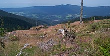
The valley is framed by the densely wooded mountain ranges of the Hohen Bogen and the Künischer Mountains in the north and the Arberkamm and Kaitersberg in the south. The eponymous market town of Lam is the largest town in the valley. In the Lamer Winkel are also the communities Lohberg and Arrach am Weißen Regen , which together with Lam form a holiday region.
history
The Lamer Winkel was developed from 1279 onwards by clearing and settlement activities directed by the Rott am Inn monastery . By 1420 most of the villages were built apart from Lam. The Hussite Wars and the Böckler War led to considerable devastation in the 15th century. In the 16th century the villages and remote farms were rebuilt. In the 19th century, the old glassworks, glass grinding mills and hammer mills in Lohberghütte and Schrenkenthal gave rise to early industrial locations.
tourism
The formerly secluded valley is one of the most scenic in the Bavarian Forest and has been heavily developed for tourism in recent decades . Hiking and biking trails as well as cross-country skiing trails are offered.
traffic
The state highways St2138 and St2154 and the Upper Palatinate Railway lead into Lamer Winkel .
