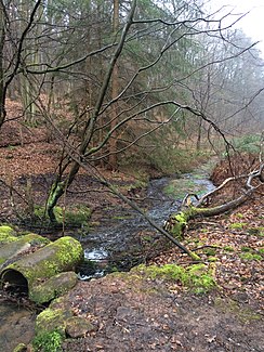
Eselsbach (Louder)
| Eselsbach | ||
| Data | ||
| Water code | DE : 254664 | |
| location | Germany | |
| River system | Rhine | |
| Drain over | Lauter → Glan → Nahe → Rhine → North Sea | |
| source | at Enkenbach-Alsenborn 49 ° 28 '59 " N , 7 ° 53" 23 " E |
|
| Source height | approx. 304 m above sea level NHN | |
| muzzle | northwest of Kaiserslautern from the right in the Lauter coordinates: 49 ° 27 '29 " N , 7 ° 44' 40" E 49 ° 27 '29 " N , 7 ° 44' 40" E |
|
| Mouth height | approx. 226 m above sea level NHN | |
| Height difference | approx. 78 m | |
| Bottom slope | approx. 6.4 ‰ | |
| length | 12.3 km | |
| Catchment area | 27.888 km² | |
The Eselsbach is a 12.3 km long right tributary of the Lauter in Rhineland-Palatinate , Germany .
geography
course
The Eselsbach rises in the north-western Palatinate Forest on the western outskirts of Enkenbach-Alsenborn at an altitude of 304 m above sea level. NHN . From here the stream flows mainly in a westerly direction and flows into the Lauter in the northwest of Kaiserslautern at 226 m on the right.
On its 12.3 km long path, the stream overcomes a height difference of 78 m, which corresponds to a mean bed gradient of 6.3 ‰. It drains a 27.888 km² catchment area via Lauter, Glan , Nahe and Rhine to the North Sea .
Tributaries
Only short tributaries flow to the Eselsbach. In the following, those are named in the order from the source to the mouth that are managed by the Rhineland-Palatinate water management authority. In each case, the orographic position of the mouth, the length, the size of the catchment area, the altitude of the mouth and the river code are given.
| Surname
|
location | Length in km |
EZG in km² |
Mouth height in m above sea level NHN |
GKZ |
|---|---|---|---|---|---|
| Dauborn Trench | Left | 1.1 | 4,000 | 259 | 254664-2 |
| Schalbrunnenbach | right | 0.6 | 1,320 | 240 | 254664-6 |
- ↑ waters code , the official in Germany watercourses code with inserted for readability separator behind the prefix uniform for all common outfall Eselsbach stands.
environment
The Eselsbach is one of the fine-material, silicate low mountain range brooks. Its water structure is mostly strongly or completely changed. Few short sections are indicated as being significantly changed. The water quality is given consistently as moderately polluted (as of 2005).
