
Esk (Forth)
|
Esk Easg |
||
 Angler in the Esk |
||
| Data | ||
| location | Midlothian and East Lothian , Scotland | |
| River system | Esk | |
| River basin district | Scotland | |
| origin | Confluence of North and South Esk 55 ° 54 ′ 40 ″ N , 3 ° 3 ′ 31 ″ W |
|
| muzzle | at Musselburgh in the Firth of Forth Coordinates: 55 ° 56 '58 " N , 3 ° 2' 58" W 55 ° 56 '58 " N , 3 ° 2' 58" W.
|
|
| Small towns | Dalkeith , Inveresk | |
The Esk ( Gäl . Easg , Engl . River Esk ) is a river flowing through Midlothian and East Lothian .
The river is fed by two separate rivers, the North Esk and the South Esk .
The North Esk flows through the North Esk Reservoir in the Pentland Hills , in Midlothian , 1.5 kilometers north of the village of Carlops . It flows northeast through Penicuik , Auchendinny , through Roslin Glen, behind Hawthornden Castle , Polton , Lasswade and Melville Castle .
The South Esk rises at the southernmost end of Midlothians, on the western slopes of Blackhope Scar (the highest of the Moorfoot Hills ). It flows north through Gladhouse Reservoir , Rosebery Reservoir, and through the village of Temple before being fed from Redside Burn near Arniston House . After Gore Water and then Dalhousie Burn flow into the South Esk to the west of Newtongrange , it flows through Newbattle Abbey and past Dalkeith .
The rivers converge 1.5 km northeast of Dalkeith on the banks of the Dalkeith House area. From here the Esk continues north for seven kilometers, flowing through Inveresk and flowing into the Firth of Forth at Musselburgh .
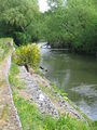
Bank erosion of the Esk
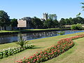
River Esk, Musselburgh

River Esk, Rennie's Bridge


Web links