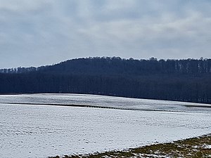
Euerberg (Steigerwald)
| Your mountain | ||
|---|---|---|
|
Your mountain |
||
| height | 491 m above sea level NHN | |
| location | Bavaria , Germany | |
| Mountains | Steigerwald | |
| Dominance | 20.78 km → Bramberg | |
| Notch height | 276 m ↓ Knetzgau | |
| Coordinates | 49 ° 55 '55 " N , 10 ° 32' 24" E | |
|
|
||
The Euerberg is 491 m above sea level. NHN after the Scheinberg (499 m), followed by the Hohenlandsberg (498 m) - both near Ippesheim - the third highest mountain in the Steigerwald . It is located in the municipality of Rauhenebrach in the southern part of the Haßberge district in Lower Franconia .
Geographical location
location
The Euerberg is 491 m u. NHN the highest mountain in the northern Steigerwald. It is located about one kilometer north of the village of Fabrikschleichach . Due to its location in the middle of the Steigerwald north-south axis, framed by similarly high elevations, it is not as distinctive as the Zabelstein, which is just under eight kilometers away and visible from afar - at least when coming from east to north . The mountain can be reached via the HAS 26 road , from Unterschleichach to Fabrikschleichach. There is no signage.
source
Between the Euerberg and the Beerberg rises at an altitude of 294 m above sea level. NHN the Aurach , a tributary of the Regnitz .
See also
Web links
Individual evidence
- ^ BayernAtlas. Retrieved December 29, 2017 .
- ^ BayernAtlas. Retrieved December 29, 2017 .

