Exton, Pennsylvania
| Exton | ||
|---|---|---|
|
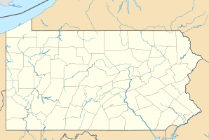
Location in Pennsylvania
|
||
| Basic data | ||
| State : | United States | |
| State : | Pennsylvania | |
| County : | Chester County | |
| Coordinates : | 40 ° 2 ′ N , 75 ° 38 ′ W | |
| Time zone : | Eastern ( UTC − 5 / −4 ) | |
| Residents : | 4,842 (as of 2010) | |
| Population density : | 583.4 inhabitants per km 2 | |
| Area : | 8.3 km 2 (approx. 3 mi 2 ) of which 8.3 km 2 (approx. 3 mi 2 ) is land |
|
| Height : | 95 m | |
| Postal code : | 19341 | |
| Area code : | +1 610 | |
| FIPS : | 42-24440 | |
| GNIS ID : | 1174394 | |
Exton is a census-designated place (CDP) in West Whiteland Township , Chester County , Pennsylvania , USA . At the 2010 census, Exton had 4,842 residents.
traffic
Exton is located at the junction of US Highway 30 (formerly "Lancaster Road", later Lincoln Highway ) and Pennsylvania Route 100. From the late 1700s, Lancaster Road became a major thoroughfare between Philadelphia and the west. Today's Route 100 was the regional north-south connection with Pottstown, Pennsylvania . One theory exists that Exton was named as the "X" on the map after this intersection (X-Town). More likely, however, the village was named after one of the Extons in England.
geography
According to the United States Census Bureau , the CDP is 8.2 km², all land area.
Personalities
- Matt Ryan (born 17 May 1985), quarterback of the Atlanta Falcons
- Kerr Smith (born March 9, 1972), actor

