
FFH area Munkbrarupau- and Schwennautal
|
FFH area Munkbrarupau- and Schwennautal
|
||
 The Schwennau flows into the Baltic Sea |
||
| location | Community Munkbrarup , Schleswig-Flensburg , Schleswig-Holstein , Germany, about 8 km east of Flensburg | |
| surface | 102 ha | |
| Identifier | 1123-305 | |
| WDPA ID | 555517777 | |
| Natura 2000 ID | DE1123305 | |
| Geographical location | 54 ° 49 ' N , 9 ° 34' E | |
|
||
| Sea level | from 0 m to 45 m | |
| Setup date | June 2004 | |
| administration | LLUR | |

The FFH area Munkbrarupau and Schwennautal (code no .: DE-1123-305) is a NATURA 2000 protected area in Schleswig-Holstein in the Schleswig-Flensburg district and was designated by the European Commission as an area of community importance in 2004 suggested. The recognition procedure according to Articles 4 and 21 of the Habitats Directive were concluded with a decision of the Commission on November 13, 2007. The area has been announced in the list of sites of Community importance for the continental region in the Official Journal of the European Union (OJ L 12 of 15.01.2008, p. 383). The area is subject to the statutory prohibition of deterioration in Section 33 (1) of the Federal Nature Conservation Act (BNatSchG). The FFH area is listed under No. 33 in the management plan according to Art. 13 of Directive 2000/60 / EC for the Schlei / Trave river basin district with the code DE_PH_1123-305. The flowing water Munkbrarupau has accordance Water Framework Directive in the upper course in the waters review the code ff_03_a and is considered "significantly modified body of water " (heavily modified waterbody = HMWB) that whereas underflow with the body of water Code ff_03_b as a "natural watercourses" classified is. The entire length of the Schwennau is classified as "natural flowing water" with the water body code ff_04.
Territory characteristics
The FFH area "Munkbrarupau- und Schwennautal" with a size of 102 ha is located south and northwest of Glücksburg . These are two spatially separate sub-areas, which, however, belong to an alluvial system. The Rüder Lake located between these two areas, also known as the “Mühlenteich”, and the Glücksburger Schlossteich do not belong to the FFH area. The conservation and, if necessary, restoration of the following habitat types have been defined as particularly important conservation objectives for the entire protected area:
- The beach lakes at the mouth of the Schwennau
- The plant community of the underwater vegetation from flooding water crowfoot
- Lime-rich fens
- Hainsimsen-Buchenwald as a typical German forest with red beech and some oaks
- Mixed ravine and hillside forests
- Alluvial forests with black alder and common ash (alder-ash- alluvial forests, white alder, willows - Weichholzau )
- The preservation of the woodruff beech forest is important.
The conservation status of the habitat types in the FFH area is largely assigned to category C (C: unfavorable.)
The protected area consists of 22% deciduous forest , 1% salt marshes, meadows and steppes, 4% inland water (standing and flowing), 12% moors , swamps, bank vegetation, 6% dry grassland , steppes and 55% moist and mesophilic grassland.
30% of the FHH area overlaps with the Flensburg Fjord landscape protection area . This only applies to the Schwennautal sub-area.
In 2017, the state government drew up an extensive management plan to secure and further develop this FFH area. A legislative procedure to place it under protection as an NSG is currently not planned. But both sub-areas are part of the protected area and biotope network system as a priority area (No. 544). FFH area management has not yet been handed over. The management plan is reviewed every 6 years. Geologically, most of the valleys are a moraine material from the ground and terminal moraines . The soil unit of the “ parabrown earths made of loam or sand over loam” dominates.
FFH sub-area Munkbrarupautal
description
The FFH area begins at the southwest end of the village of Munkbrarup , where the previously wide valley narrows sharply from the east-west to the north. At 150 m wide, the side slopes rise up to 20 m. The river "Munkbrarupau" has a length of 5.3 km, 3.6 km of which is in the FFH area. The difference in altitude from the source to the entrance to the Rüder See is 16 meters. When entering the FFH area to the south of the protected area at the sewage treatment plant of the municipality of Munkbrarup, she has already covered 1.7 km. It then turns north and crosses the B199. The approximately 2 m wide Munkbrarupau has hardly been regulated in its valley due to the sufficient gradient. It flows through the upper valley area as a typical, flat meadow stream in natural meanders to the Rüder See. The water then reaches the Schwennau via the Glücksburg Castle pond and finally into the Baltic Sea . The Munkbrarupau is only a few kilometers from the watershed of the Cimbrian Peninsula . The Kielstau, which flows 6 km south of Markerup , is already draining into the North Sea via Treene and Eider .
Conservation object and conservation goal
In accordance with Annex I of the Habitats Directive, the Habitats Directive, 5 conservation objects have been defined as conservation objectives for the Munkbrarupautal sub-area, see MP and map.
Analysis and evaluation
The conservation objectives were analyzed and evaluated, see MP. The state of preservation has been mapped, see map.
activities
A comprehensive catalog of measures was created from analysis and evaluation and documented in action sheets, see MP, action sheets and map.
Monitoring
The success of the measures is checked every 6 years. The above management plan reflects the status of November 28, 2017.
Picture gallery

Windmill Hope at the Munkbrarupau

Munkbrarupau passes under the L96

Loop of the Munkbrarupau south of the L96
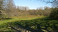
Munkbrarupautal south of the L96

.jpg)
.jpg)
.jpg)
FHH sub-area Schwennautal
description
The Schwennautal sub-area lies entirely in the municipality of Glücksburg. It begins in the south on the edge of the Flensburg State Forest on the north side of Wilhelminenstrasse, where the Schwennau passes under it. After 150 m from the east, the runoff of the Glücksburg Castle pond meets the Schwennau. The water originally comes from the Munkbrarupau. The area follows the course of the Schwennau in a width of 100 m to 200 m. After crossing under Paulinenallee, the Schwennau flows into an Auental valley with reeds and reeds that widens to 300 m until it finally pours into the Baltic Sea. The largest extension of the sub-area is 1.3 km.
Conservation object and conservation objectives
The object of conservation and the conservation objectives for the entire area have been defined in the management plan for sub-area 2 Schwennautal. The existing biotope types and habitat types were mapped.
Analysis and evaluation
The conservation objectives were analyzed and evaluated. The state of preservation has been mapped.
activities
and the resulting measures are described and recorded and updated in measures sheets. These are subject to constant monitoring and adjustment.
Monitoring
The success of the measures is checked every 6 years. The above management plan reflects the status of November 28, 2017.
Picture gallery
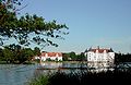
Glücksburger Schlossteich is the source of the Schwennau

Bridge over the Schwennau in front of the confluence with the Flensburg Fjord

The Schwennau flows into the Flensburg Fjord

Relaxation at the mouth of the Schwennau (outside the FFH area)


Other species and biotopes
The management plan of the Ministry for Energy Transition, Agriculture, Environment, Nature and Digitization of the State of Schleswig-Holstein for the fauna-flora-habitat area "Munkbrarupau- und Schwennautal" deals almost exclusively with the area of flora.
The fauna is only represented with the tree frog and a sighting of the otter in both sub-areas under “Other species and biotopes”.
Web links
- Reading instructions for standard data sheets for the transmission of information on Natura 2000 areas (2011/484 / EU) (PDF; 588 KB), State Office for Agriculture, Environment and Rural Areas of Schleswig-Holstein
- The habitat types and species (protected objects) of the Habitats and Birds Directive , Federal Agency for Nature Conservation, October 24, 2019 (HTML)
- Species and habitat protection in NATURA 2000 state forests (PDF 1.5 MB), Schleswig-Holstein State Forests
- INTERPRETATION MANUAL OF EUROPEAN UNION HABITATS , EUROPEAN COMMISSION DG ENVIRONMENT, April 2013 (PDF)
- List of FFH areas in Schleswig-Holstein
Individual evidence
- ↑ Management plan for the fauna-flora-habitat area DE-1123-305 “Munkbrarupau- und Schwennautal”. (PDF; 1251 KB) State Office for Agriculture, Environment and Rural Areas (LLUR) of the State of Schleswig-Holstein, November 28, 2017, p. 4 , accessed on March 27, 2020 .
- ↑ Management plan according to Art. 13 of Directive 2000/60 / EC for the Schlei / Trave river basin district. (PDF) Appendix A3-4: FFH and bird protection areas Table 1: List of FFH areas according to RL 92/43 / EEC. In: Schleswig-Holstein state portal. Ministry of Agriculture, Environment and Rural Areas Schleswig-Holstein, p. 232 , accessed on April 30, 2020 .
- ↑ HMWB case groups. In: gewaesser-evaluation.de. Federal Environment Agency and the Federal / State Working Group on Water, 2020, accessed on May 1, 2020 .
- ↑ Management plan according to Art. 13 of Directive 2000/60 / EC for the Schlei / Trave river basin district. (PDF) Appendix 5: List of environmental goals and justifications. In: Schleswig-Holstein state portal. Ministry of Agriculture, Environment and Rural Areas Schleswig-Holstein, p. 246 , accessed on May 1, 2020 .
- ↑ FFH area profile. (PDF) Munkbrarupau and Schwennautal. In: Schleswig-Holstein state portal. Landesregierung Schleswig-Holstein, p. 1 , accessed on March 23, 2020 .
- ↑ FFH area 1123-305 Munkbrarupau and Schwennautal. Profiles of the Natura 2000 areas. In: Natura 2000 database. Federal Agency for Nature Conservation, 2018, accessed on March 23, 2020 .
- ^ Munkbrarupau- and Schwennautal in Germany. In: Protected Planet. UN Environment Program, 2004, accessed on March 23, 2020 (areas clearly visible on the map).
- ↑ Munkbrarupau and Schwennautal. DE1123305. In: NATURA 2000 - STANDARD DATA FORM. European Environment Agency, May 2017, accessed February 24, 2020 .
- ↑ a b Management plan FFH 1123-305 "Munkbrarupau and Schwennautal". (PDF; 1112 KB) Map 1 - overview-. State Office for Agriculture, Environment and Rural Areas of the State of Schleswig-Holstein (LLUR), March 29, 2017, accessed on March 26, 2020 .
- ↑ a b Conservation goals for the legally protected area of community importance DE-1123-305 "Munkbrarupau- und Schwennautal". In: Reference: Official Journal for Schleswig Holstein. - Issue No. 47, page 1033. Ministry for Energy Transition, Agriculture, Environment and Rural Areas, July 11, 2016, pp. 1–3 , accessed on March 25, 2020 .
- ↑ Management plan for the fauna-flora-habitat area DE-1123-305 “Munkbrarupau- und Schwennautal”. (PDF) 3.1. Habitat types according to Annex I of the Habitats Directive. State Office for Agriculture, Environment and Rural Areas (LLUR), November 28, 2017, p. 9 , accessed on March 26, 2020 .
- ↑ STANDAR D-DATE NBOGEN for special protection areas (BSG). (PDF) DE1123305. In: Official Journal of the European Union. European Union, May 2019, pp. 6–7 , accessed on March 25, 2020 : "Area shares according to habitat classes"
- ↑ STANDAR D-DATE NBOGEN for special protection areas (BSG). (PDF) DE1123305. In: Official Journal of the European Union. European Union, May 2019, p. 9 , accessed on March 25, 2020 (30% overlap with LSG Flensburger Förde).
- ↑ Management plan for the fauna-flora-habitat area DE-1123-305 “Munkbrarupau- und Schwennautal”. (PDF) State Office for Agriculture, Environment and Rural Areas (LLUR), November 28, 2017, accessed on March 25, 2020 .
- ↑ Management plan for the fauna-flora-habitat area DE-1123-305 “Munkbrarupau- und Schwennautal”. (PDF; 1251 KB) 2.5. Protection status and existing plans. Ministry for Energy Transition, Agriculture, Environment, Nature and Digitization of the State of Schleswig-Holstein, November 28, 2017, p. 8 , accessed on March 27, 2020 .
- ↑ Management plan for the fauna-flora-habitat area DE-1123-305 “Munkbrarupau- und Schwennautal”. (PDF; 1251 KB) 6.4.4 FFH area management. Ministry for Energy Transition, Agriculture, Environment, Nature and Digitization of the State of Schleswig-Holstein, November 27, 2017, p. 27 , accessed on March 27, 2020 .
- ↑ a b Management plan for the fauna-flora-habitat area DE-1123-305 "Munkbrarupau- und Schwennautal". (PDF; 1251 KB) 7. Success control and monitoring of the measures. Ministry for Energy Transition, Agriculture, Environment, Nature and Digitization of the State of Schleswig-Holstein, November 27, 2017, p. 29 , accessed on March 27, 2020 .
- ↑ Management plan for the fauna-flora-habitat area DE-1123-305 “Munkbrarupau- und Schwennautal”. (PDF; 1251 KB) 2.1. Area description. Ministry for Energy Transition, Agriculture, Environment, Nature and Digitization of the State of Schleswig-Holstein, November 27, 2017, p. 5 , accessed on March 27, 2020 .
- ↑ Management plan for the fauna-flora-habitat area DE-1123-305 “Munkbrarupau- und Schwennautal”. (PDF; 1251 KB) 3rd object of preservation, area 1 Munkbrarupau. In: Schleswig-Holstein state portal. Ministry for Energy Transition, Agriculture, Environment, Nature and Digitization of the State of Schleswig-Holstein, July 28, 2017, p. 7 , accessed on April 18, 2020 .
- ↑ Management plan FFH 1123-305 "Munkbrarupau and Schwennautal". (PDF; 1892 KB) Map 2b - Habitat types. In: Schleswig-Holstein state portal. Ministry for Energy Transition, Agriculture, Environment and Rural Areas of the State of Schleswig-Holstein, March 29, 2017, accessed on April 18, 2020 .
- ↑ Management plan for the fauna-flora-habitat area DE-1123-305 “Munkbrarupau- und Schwennautal”. (PDF; 1251 KB) Area 1 (Munkbrarupautal). In: Schleswig-Holstein state portal. Ministry of Energy Transition, Agriculture, Environment and Rural Areas of the State of Schleswig-Holstein, November 18, 2017, pp. 15–16 , accessed on April 18, 2020 .
- ↑ Management plan FFH 1123-305 "Munkbrarupau and Schwennautal". (PDF; 1870 KB) Map 2c - Conservation status - Sub-area 1 Munkbrarupautal. In: Schleswig-Holstein state portal. State Office for Agriculture, Environment and Rural Areas of the State of Schleswig-Holstein, March 29, 2017, accessed on March 26, 2020 .
- ↑ Management plan for the fauna-flora-habitat area DE-1123-305 “Munkbrarupau- und Schwennautal”. (PDF; 1251 KB) 6. Catalog of measures. In: Schleswig-Holstein state portal. Ministry for Energy Transition, Agriculture, Environment and Rural Areas of the State of Schleswig-Holstein, November 28, 2017, pp. 19-29 , accessed on April 19, 2020 .
- ↑ a b Management plan for the fauna-flora-habitat area DE-1123-305 "Munkbrarupau- und Schwennautal". Action sheets. Ministry for Energy Transition, Agriculture, Environment, Nature and Digitization of the State of Schleswig-Holstein, 2017, pp. 1–41 , accessed on March 27, 2020 .
- ↑ Management plan FFH 1123-305 "Munkbrarupau and Schwennautal" sub-area 1. (PDF; 1817 KB) Map 5a - Measures -. In: Schleswig-Holstein state portal. Ministry for Energy Transition, Agriculture, Environment and Rural Areas of the State of Schleswig-Holstein, September 27, 2017, accessed on April 19, 2020 .
- ↑ Management plan for the fauna-flora-habitat area DE-1123-305 “Munkbrarupau- und Schwennautal”. (PDF; 1251 KB) Annex 1: 1. Subject of preservation. Ministry for Energy Transition, Agriculture, Environment, Nature and Digitization of the State of Schleswig-Holstein, November 28, 2017, p. 31 , accessed on March 28, 2020 .
- ↑ Management plan for the fauna-flora-habitat area DE-1123-305 “Munkbrarupau- und Schwennautal”. (PDF; 1251 KB) Annex 1 2nd conservation objectives. Ministry for Energy Transition, Agriculture, Environment, Nature and Digitization of the State of Schleswig-Holstein, November 28, 2017, pp. 31–33 , accessed on March 28, 2020 .
- ↑ Management plan for the fauna-flora-habitat area DE-1123-305 “Munkbrarupau- und Schwennautal”. (PDF; 2363 KB) Map 2a - Biotope types sub-area 2 Schwennautal. Ministry for Energy Transition, Agriculture, Environment, Nature and Digitization of the State of Schleswig-Holstein, March 29, 2017, p. 2 , accessed on March 28, 2020 .
- ↑ Management plan FFH1123-305 "Munkbrarupau- and Schwennautal". (PDF; 2064 KB) Sub-area 2 -Schwennautal- Map 2b - Habitat types. In: Schleswig-Holstein state portal. Ministry for Energy Transition, Agriculture, Environment and Rural Areas of the State of Schleswig-Holstein, March 29, 2017, accessed on April 19, 2020 .
- ↑ Management plan for the fauna-flora-habitat area DE-1123-305 “Munkbrarupau- und Schwennautal”. (PDF; 2233 KB) Map 2c - Conservation status of sub-area 2 Schwennautal. Ministry for Energy Transition, Agriculture, Environment, Nature and Digitization of the State of Schleswig-Holstein, March 29, 2017, p. 1 , accessed on March 27, 2020 (Schwennau).
- ↑ Management plan for the fauna-flora-habitat area DE-1123-305 “Munkbrarupau- und Schwennautal”. (PDF; 2654 KB) Section 2 Schwennautal Map 5a - Measures. Ministry for Energy Transition, Agriculture, Environment, Nature and Digitization of the State of Schleswig-Holstein, September 27, 2017, p. 2 , accessed on March 28, 2020 .
- ↑ Management plan for the fauna-flora-habitat area DE-1123-305 “Munkbrarupau- und Schwennautal”. (PDF; 1251 KB) 7. Success control and monitoring of the measures. Ministry for Energy Transition, Agriculture, Environment, Nature and Digitization of the State of Schleswig-Holstein, November 27, 2017, p. 29 , accessed on March 27, 2020 .
- ↑ Management plan for the fauna-flora-habitat area DE-1123-305 “Munkbrarupau- und Schwennautal”. (PDF; 1251 KB) 3.3. Other species and biotopes. Ministry for Energy Transition, Agriculture, Environment, Nature and Digitization of the State of Schleswig-Holstein, November 28, 2018, p. 13 , accessed on March 28, 2020 .