Felderstrasse (Vienna)
| Felderstrasse | |
|---|---|
| Street in Vienna, Inner City | |
| Basic data | |
| place | Vienna, inner city |
| District | Inner city |
| Created | 1874 |
| Hist. Names | Magistratsstrasse (until 1899) |
| Cross streets | Rathausplatz , Ebendorferstrasse , Rathausstrasse |
| Buildings | townhall of Vienna |
| use | |
| User groups | Pedestrians , cyclists , car traffic |
| Technical specifications | |
| Street length | about 113 meters |
The fields Street is located in the first Viennese district, the Inner City . It was named in 1899 after the mayor of Vienna, Cajetan von Felder .
history
The Felderstrasse lies in the area of the former ( Josefstädter ) parade and parade ground in front of the walls of Vienna, originally part of the Glacis . When the site was built on as planned from the beginning of the 1870s, it formed the northern boundary line of the new Vienna City Hall , which has been under construction since 1872 and the seat of the City of Vienna's Magistrate . So in 1874 the street name Magistratsstraße was created . In 1899 this name was dropped in favor of the mayor Felder, who had died five years earlier and who had laid the foundation stone for the town hall building both politically and physically. In 1870, through several interventions, Felder had persuaded Emperor Franz Joseph I to give up the parade and parade ground so that the New Town Hall could be built here.
Location and characteristics
Felderstrasse is a street on the northern side of the New Town Hall that encompasses only two blocks. It begins in the city center at the Rathausplatz , where it meets the northern part of the Rathauspark . Across from the Felderstrasse entrance, one of the two main entrances to the town hall, the Ebendorferstrasse from the north opens. In the west, Felderstrasse ends at the northeast corner of Friedrich-Schmidt-Platz at the confluence of Rathausstrasse in this square. There are continuous arcades on the north side of the street . The buildings on Felderstrasse are now exclusively office buildings.
building
No. 1: Vienna City Hall
The right, northern side front with one of the entrance gates of the Vienna City Hall is located on Felderstrasse . It was built in a neo-Gothic style by Friedrich von Schmidt in 1872–1883 and has its front at Rathausplatz 1. The Vienna Library in the City Hall can be reached via the Felderstrasse entrance via staircase 4 on the first floor . A historical paternoster that is still in operation is located near this entrance .
No. 2 and 4: Field house
The block between Ebendorferstraße, Grillparzerstraße and Rathausplatz was built as one of the arcade houses in 1880–1883 by Franz von Neumann in a strictly historical style. The component on Felderstrasse was badly damaged in World War II. In 1964 it was renewed according to plans by Erich Boltenstern . While the upper part of the building is an unadorned new building, the arcades on the street have largely been restored. This part of the block, Rathausplatz 2 / Felderstraße 4 / Ebendorferstraße 2, is called the Field House and is used as the municipal office.
No. 6 and 8: Städtisches Amtshaus (Vienna City Planning House)
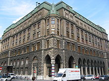
The office building was built by August Kirstein from 1913 to 1918 as the last arcade house in the town hall district . The architect combined neo-Gothic forms with those of Art Nouveau . At the corner of Rathausstrasse there is a set corner tower as a striking detail. On the Felderstraße there are pointed arch arcades that rest on Gothic stone columns. While the base zone is embossed and rusticated , the upper floors have exposed bricks with secessionist plastered fields. Four busts can be seen under the cornice on the corner tower. The slate roof and attic was after a night of 25 erupted on August 26, 1927 fire as refractory, modern roof re-executed.
In the arcade on Felderstrasse there are ribbed vaults that are richly stuccoed . While tendrils are attached to the caps, medallions of the twelve months and signs of the zodiac can be seen on the straps. Under the corner tower, in a pilaster-framed niche, stands the soldier in iron , a knight figure made of wood that was studded over and over with iron nails in the course of a fundraising campaign during the First World War. The figure was created by Josef Müllner in 1914 and placed in this location in 1934, during the period of the corporate state dictatorship . Above the military man there is an inscription with a poem by the now controversial poet priest Ottokar Kernstock .
The wooden gates on the side facades have wrought iron flowers. In the inner courtyard, the rich floral secessionist stucco over the windows is remarkable. In the foyers there are gothic stucco coffered ceilings as well as tapes of inscriptions depicting the virtues. Red-brown marble columns and sheet brass lanterns can also be seen in the foyer on Rathausstrasse.
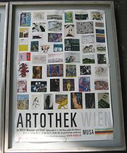
Here, the MA18 is urban development and urban planning settled that her home city planning house calls. The MUSA Museum on Demand is located on the ground floor of the building , in which changing parts of the rich collections of modern art in the City of Vienna are exhibited. The Artothek is also located here , where you can borrow works of art owned by the City of Vienna.
literature
- Bundesdenkmalamt (Ed.): Dehio-Handbuch Wien. I. District - Inner City. Verlag Berger, Horn 2003, p. OA
Web links
Individual evidence
- ^ The fire in the official building of the City of Vienna. Thirty thousand schillings damage. In: Neue Freie Presse , Morgenblatt, No. 22609/1927, August 27, 1927, p. 6, top right. (Online at ANNO ). .
- ↑ Vienna City Planning House. ( Memento of the original from March 25, 2016 in the Internet Archive ) Info: The archive link was inserted automatically and has not yet been checked. Please check the original and archive link according to the instructions and then remove this notice. wien.gv.at → Stadtentwicklung → Dienststellen → MA18 (accessed March 23, 2016).
Coordinates: 48 ° 12 ′ 42 " N , 16 ° 21 ′ 27.1" E


