Long Island (Bahamas)
| long Island | ||
|---|---|---|
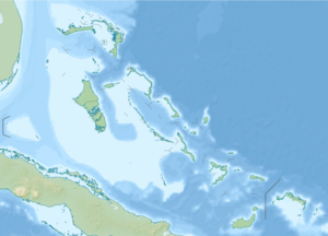
| Map of Long Island | ||
| Waters | Atlantic Ocean | |
| Archipelago | Bahamas | |
| Geographical location | 23 ° 16 ′ N , 75 ° 6 ′ W | |
|
|
||
| length | 130 km | |
| width | 6 km | |
| surface | 448 km² | |
| Residents | 3024 (2010) 6.8 inhabitants / km² |
|
| main place | Clarence Town | |
Long Island is an island in the Bahamas and is 130 km long and up to six km wide. The island is located 265 km southeast of the Bahamas capital Nassau . At the 2010 census, the island had 3,024 inhabitants (including the island of Galliot Cay off the northern tip ). The largest town was Burnt Ground with 324 residents, followed by Lower Deadman's Cay with 272 residents and Hamilton with 196 residents. Only 86 inhabitants lived in the main town of Clarence Town .
It has become of tourist interest through its "Shark Diving" offers at the Stella Maris Resort, as well as through the historical connections with Christopher Columbus in 1492, when he is said to have fetched water on this island on his way to America. Columbus named the island Fernandina in honor of his king Fernando II .
Sights and attractions
- " Dean's Blue Hole ", an underwater cave with a depth of up to 202 m
- Columbus Monument
- Sts. Peter and Paul Catholic Church in Clarence Town
Besides tourism, the main branch of the economy is agriculture and animal husbandry.
traffic
There are two airfields on Long Island. A little south of the center of the island is Deadman's Cay Airport ( IATA airport code : LGI, ICAO code : MYLD), almost on the northern tip of the smaller Stella Maris Airport (IATA: SML, ICAO: MYLS).
Individual evidence
- ^ Long Island Population By Settlements and Occupied Dwellings: Census 2010
- ↑ Cristóbal Colón en Cuba (October 1492) , Historia de las Canarias, accessed March 28, 2013
- ↑ Airfield overview Deadman's Cay Airport , Aviation Safety Network , accessed on June 23, 2017.
- ↑ Airfield overview Stella Maris-Estate airstrip , Aviation Safety Network (English), accessed on June 23, 2017.


