Les Eplatures airfield
| Aéroport Les Éplatures | |
|---|---|

|
|
| Characteristics | |
| ICAO code | LSGC |
| IATA code | ZHV |
| Coordinates | |
| Height above MSL | 1026 m (3366 ft ) |
| Transport links | |
| Distance from the city center | 2 km southwest of La Chaux-de-Fonds |
| Street | Hauptstrasse 20 |
| train | La Chaux-de-Fonds train station |
| Local transport | Bus 360/361, Les Éplatures / Aéroport stop |
| Basic data | |
| opening | 1927 |
| operator | Aéroport Les Éplatures |
| Passengers | 8,112 (2011) |
| Flight movements |
15,407 (2011) |
| Employees | 15 (2006) |
| Start-and runway | |
| 06/24 | 1165 m × 27 m asphalt |
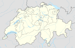
Locations of the 11 Swiss regional airports |
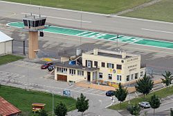
The airport Les Éplatures ( French Aéroport Les Éplatures , ICAO code LSGC ) is one of the seven regional airports without scheduled traffic in Switzerland . It is located in the Les Éplatures district of La Chaux-de-Fonds .
Flight operations
The airfield is open all year round from 8 a.m. to 8 p.m., has several hangars , customs clearance and Schengen approval . It is the highest international airport in Europe with an instrument landing system and is mainly used for private and business aviation as well as for training flights.
The region in the Neuchâtel Jura is an important location for the watch industry and microelectronics. Business flights by companies in the catchment area in Switzerland and neighboring France generate around 35% of the airport's income. Charter flights to holiday destinations are carried out to a very limited extent.
history
The first flight meeting on the meadow in Les Éplatures took place in 1912, followed by a larger event in 1916 with the participation of the army . In July 1927, the first airport building was put into operation, and the first hard runway with a length of 740 m followed in 1956 (extended to 845 m in 1972).
In 1986 the tower was built, the runway completely renewed and equipped with lighting . The instrument landing system went into operation four years later. In 1998 taxiways were built and the runway was extended to 1,100 m, followed by a further expansion to 1,165 m in 2002.
Web links
- Official website
- Les Eplatures airport on the ETHorama platform
Individual evidence
- ↑ a b FOCA - Swiss Civil Aviation. (No longer available online.) Archived from the original on May 26, 2014 ; Retrieved March 24, 2012 . Info: The archive link was inserted automatically and has not yet been checked. Please check the original and archive link according to the instructions and then remove this notice.
- ↑ a b c d Canton Neuchâtel, information from May 23, 2011: Maintenir l'aéroport civil d'importance régionale, page 3, accessed on May 25, 2014 (French)
- ↑ Flight review of October 1, 2013: Civil airports in Switzerland accessed on May 25, 2014
- ↑ RTS info of June 6, 2013: L'aéroport des Eplatures inaugure une liaison avec l'Ile d'Elbe , accessed on May 25, 2014 (French)
- ↑ Sandro Fehr: The development of the third dimension. Origin and development of the civil aviation infrastructure in Switzerland, 1919–1990 . Chronos Verlag, Zurich 2014, ISBN 978-3-0340-1228-7 , p. 289.
