Les Eplatures
| Les Eplatures | ||
|---|---|---|
| State : |
|
|
| Canton : |
|
|
| District : | No district division | |
| Municipality : | La Chaux-de-Fonds | |
| Postal code : | 2300 | |
| Coordinates : | 551095 / 215 034 | |
| Height : | 1013 m above sea level M. | |
|
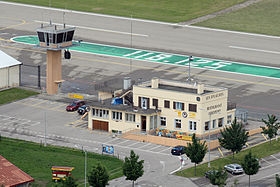
Les Eplatures airfield |
||
| map | ||
|
|
||
Les Eplatures is a south-western district of La Chaux-de-Fonds in the canton of Neuchâtel in Switzerland and a formerly independent political municipality .
Until 1848 the former farming village of Les Eplatures belonged to the municipality of Le Locle , then it was divided into the district of La Chaux-de-Fonds and raised to an independent municipality. In 1850 the village had 1,320 inhabitants. The Reformed Church was built in 1853 and a Jewish cemetery in 1873. The opening of the railway line in 1858 and increasing industrialization brought the town of La Chaux-de-Fonds closer and closer. A petition from the residents of Les Eplatures led to the incorporation in 1900. In 1926 the regional airfield Les Eplatures was opened. Today the district is connected to local public transport by the La Chaux-de-Fonds trolleybus .
The most famous resident of Les Eplatures was the painter Louis Léopold Robert , after whom the main main street in La Chaux-de-Fonds is named.
Web links
- Myriam Volorio Perriard: Eplatures, Les. In: Historical Lexicon of Switzerland .


