Noiraigue
| Noiraigue | ||
|---|---|---|
| State : |
|
|
| Canton : |
|
|
| District : | No district division | |
| Municipality : | Val-de-Travers | |
| Postal code : | 2103 | |
| former BFS no. : | 6508 | |
| Coordinates : | 545575 / 200 747 | |
| Height : | 729 m above sea level M. | |
| Area : | 6.38 km² | |
| Residents: | 506 (December 31, 2007) | |
| Population density : | 79 inhabitants per km² | |
|
Village with clusette |
||
| map | ||
|
|
||
Noiraigue was a municipality in the Val-de-Travers district of the canton of Neuchâtel in Switzerland until December 31, 2008 .
Since January 1, 2009 Noiraigue belongs together with Boveresse , Buttes , Couvet , Fleurier , Les Bayards , Môtiers , Saint-Sulpice and Travers merged to Val-de-Travers .
geography
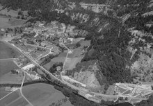
Noiraigue is 729 m above sea level. M. , 16 kilometers west-southwest of the canton capital Neuchâtel (linear distance ). The clustered village extends at the karst source of the Noiraigue in a basin of the Areuse before entering the valley of Clusette, in the eastern Val de Travers , surrounded by the heights of the Neuchâtel Jura .
The area of the 6.4 km² former municipal area comprises the easternmost part of the Val de Travers. The Areuse forms a basin between the steep slopes of the Côte de Rosières in the north and the Côte de Rortier in the south and has a flat valley floor around 600 m wide. The northern border ran over the height of the Combe Varin ( 1075 m above sea level ) and Clusette ( 1119 m above sea level ) and extended to the southern edge of the high valley Vallée des Ponts . The southern border lay on the Dos d'Ane , the northern crest of the Creux du Van cirque . On the north slope of the Soliat was at 1360 m above sea level. M. reaches the highest point of Noiraigue. In 1997, 7% of the municipal area was in settlements, 70% in forests and woodlands, 21% in agriculture and around 2% was unproductive land.
Some individual farms in the valley and on the heights of the Jura belonged to Noiraigue. Neighboring communities of Noiraigue were Travers , Brot-Plamboz , Brot-Dessous , Boudry and Gorgier .
population
With 506 inhabitants (end of 2007), Noiraigue was one of the small communities in the canton of Neuchâtel. 88.4% of the residents are French-speaking, 4.1% German-speaking and 3.2% speak Albanian (as of 2000). The population of Noiraigue rose sharply from 1850 (241 inhabitants) to 1900 (954 inhabitants), but since then it has halved again due to emigration.
economy
Noiraigue was an agricultural village until the middle of the 19th century . As early as the 17th century, there were a few blast furnaces, mills, a sawmill and forges along the Areuse. Rapid industrialization then set in , with the main branches of business initially in lace making and the watch industry , later a lime and cement factory and a factory in which skis were made were added. Today there are some construction companies and a hydroelectric plant. Agriculture focuses on livestock and dairy farming .
traffic
The former community is well developed in terms of traffic. It is located below the main road from Neuchâtel via the border crossing Les Verrières to Pontarlier in France . This bypasses the bottleneck of the Clusette in an approximately 1 km long tunnel. On July 25, 1860, the railway line from Auvernier to Les Verrières was opened with a station in Noiraigue ( Neuchâtel – Pontarlier line ).
history
The first written mention of the place dates back to 998 under the name Nigra aqua . This Latin word meaning black water refers to the water of the Noiraigue, which is often darkly clouded by the boggy soils in the Vallée des Ponts, the catchment area of the karst spring. The area around Noiraigue was already explored in the Neolithic , which is attested by the discovery of an ax from this period.
Noiraigue belonged to the Saint-Pierre priory in Môtiers until the 14th century , after which it was subject to the Kastlanei Val-de-Travers until 1848. During this time, the county of Neuchâtel had sovereignty over the area. From 1648 Neuchâtel was a principality and from 1707 it was linked to the Kingdom of Prussia through personal union. In 1806 the area was ceded to Napoleon I and came to the Swiss Confederation in the course of the Congress of Vienna in 1815 , whereby the kings of Prussia until the Neuchâtel trade in 1857 also remained princes of Neuchâtel. In 1719 numerous houses fell victim to a village fire.
Attractions
The current construction of the church dates from 1894, before there was a chapel at this point. Noiraigue belonged to the parish of Travers until 1879, since then it has formed its own parish. The Catholic chapel was built in 1889.
photos
literature
- Jean Courvoisier: The Art Monuments of the Canton of Neuchâtel, Volume III: Les districts du Valde-Travers, du Val-de-Ruz, du Locle et de La Chaux-de-Fonds. (= Art Monuments of Switzerland. Volume 56). Edited by the Society for Swiss Art History GSK. Bern 1968.
Web links
- Information on Noiraigue
- Eric-André Klauser: Noiraigue. In: Historical Lexicon of Switzerland .


