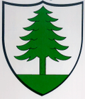
Le Pâquier NE
| NE is the abbreviation for the canton of Neuchâtel in Switzerland and is used to avoid confusion with other entries of the name Le Pâquier . |
| Le Pâquier | ||
|---|---|---|
| State : |
|
|
| Canton : |
|
|
| District : | No district division | |
| Municipality : | Val-de-Ruz | |
| Postal code : | 2058 | |
| former BFS no. : | 6483 | |
| Coordinates : | 565 754 / 216654 | |
| Height : | 895 m above sea level M. | |
| Area : | 9.58 km² | |
| Residents: | 212 (December 31, 2012) | |
| Population density : | 22 inhabitants per km² | |
| map | ||
|
|
||
Le Pâquier was a municipality in the Val-de-Ruz district in the canton of Neuchâtel in Switzerland . On January 1st, 2013 it merged with the municipalities of Boudevilliers , Cernier , Chézard-Saint-Martin , Coffrane , Dombresson , Engollon , Fenin-Vilars-Saules , Fontainemelon , Fontaines , Les Geneveys-sur-Coffrane , Les Hauts-Geneveys , Montmollin , Savagnier and Villiers to form the new municipality of Val-de-Ruz .
geography
Le Pâquier is 895 m above sea level. M. , 13 km north-northeast of the canton capital Neuchâtel (linear distance). The farming village extends in a valley widening of the creek Ruz de Chasseran above the Klus of Chenau , in Neuchâtel Jura west of the Chasseral .
The area of the 9.6 km² municipal area includes the valley widening of Le Pâquier, which is bounded in the south by the gorge of Chenau and the height of Les Planches . To the north, the municipality extends over the Le Chargeoir forest ridge ( 1245 m above sea level ), which belongs to the Jura range of Mont d'Amin, to the height of La Joux du Plane and the Col des Pontins pass . The eastern border of the municipality lies on the western slope of the Chasseral chain and includes the Forêt d'Aigremont , the lower part of the erosion valley Combe Biosse and the Rumont . At the height of the Rumont is at 1440 m above sea level. M. reached the highest point of the municipality. On the Jura heights there are extensive high pastures with the typical mighty spruce trees , which either stand individually or in groups. In 1997, 3% of the municipal area was accounted for by settlements, 51% for forests and woodlands and 46% for agriculture.
Le Pâquier includes the hamlets of Le Côty , 892 m above sea level. M. in the valley west of the village, La Joux du Plane ( 1159 m above sea level ) and Les Bugnenets ( 1091 m above sea level ) on the Jura heights between Mont d'Amin and Chasseral as well as some individual farms. Neighboring communities of Le Pâquier are Dombresson and Villiers in the canton of Neuchâtel and Saint-Imier and Sonvilier in the canton of Bern .
population
With 212 inhabitants (as of December 31, 2012), Le Pâquier is one of the small communities in the canton of Neuchâtel. 89.6% of the residents are French-speaking, 9.5% German-speaking and 0.9% Portuguese-speaking (as of 2000). The population of Le Pâquier decreased from 1850 (then 341 inhabitants) to 1950 (210 inhabitants), since then it has remained about the same.
economy
Le Pâquier is still today a mainly agricultural village, with cattle breeding and dairy farming predominating. Outside the primary sector, there are some jobs in local small businesses. Many people in employment are also commuters and work in the Val de Ruz and Neuchâtel.
The region around the Col des Pontins is a popular excursion destination and recreation area with a few holiday and weekend houses and two ski areas on the western slope of the Chasseral chain; on the one hand on the Crêt-du-Puy a little below the village, on the other hand also at Les Bugnenets , where Didier Cuche learned to ski. Cross-country skiing can also be practiced on the Jura heights.
traffic
The municipality is located on the cantonal road from Neuchâtel over the Col des Pontins pass to Saint-Imier . Le Pâquier has no connection to the public transport network.
history
The first written mention of the village was in 1328 under the name Pasquier , which is derived from the late Latin pasquerium ( pasture area , pasture area ). Le Pâquier belonged to the lordship of Valangin , which was partly subordinate to the Counts of Neuchâtel, partly to the Counts of Montbéliard and finally came to Neuchâtel in 1592. From 1648 Neuchâtel was a principality and from 1707 it was linked to the Kingdom of Prussia through personal union. In 1806 the area was ceded to Napoleon I and came to the Swiss Confederation in the course of the Congress of Vienna in 1815 , whereby the kings of Prussia until the Neuchâtel trade in 1857 also remained princes of Neuchâtel. Le Pâquier does not have its own church, it belongs to the parish of Dombresson .
Attractions
Personalities
The famous former ski racer Didier Cuche was born in Le Pâquier.
Web links
- Maurice Evard: Le Pâquier (NE). In: Historical Lexicon of Switzerland .


