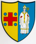
Chézard-Saint-Martin
| Chézard-Saint-Martin | ||
|---|---|---|
| State : |
|
|
| Canton : |
|
|
| District : | No district division | |
| Municipality : | Val-de-Ruz | |
| Postal code : | 2054 | |
| former BFS no. : | 6473 | |
| Coordinates : | 560562 / 212 826 | |
| Height : | 764 m above sea level M. | |
| Area : | 13.05 km² | |
| Residents: | 1819 (December 31, 2012) | |
| Population density : | 139 inhabitants per km² | |
| Website: | chezard-saint-martin.ne.ch | |
| map | ||
|
|
||
Chézard-Saint-Martin was a municipality in the Val-de-Ruz district in the canton of Neuchâtel in Switzerland . On January 1, 2013 it merged with the municipalities of Boudevilliers , Cernier , Coffrane , Dombresson , Engollon , Fenin-Vilars-Saules , Fontainemelon , Fontaines , Les Geneveys-sur-Coffrane , Les Hauts-Geneveys , Montmollin , Le Pâquier , Savagnier and Villiers to the new municipality of Val-de-Ruz .
geography
Chézard-Saint-Martin lies at 764 m above sea level. M. , eight kilometers north of the canton capital Neuchâtel (linear distance ). The double community extends on the northern edge of the Val de Ruz basin in the Neuchâtel Jura , at the foot of the Mont d'Amin .
The area of the 13.1 km² municipal area comprises in the southern part a section of the agriculturally intensively used basin of the Val de Ruz and extends to the Seyon . To the north, the area extends over the steep slope of the Forêt du Bas to the anticline of Mont d'Amin. At this height is 1417 m above sea level. M. reached the highest point of the municipality. To the north of Mont d'Amin, the municipal soil extends in a narrow corner over the Klustal des Pertuis and the Combe Mauley to the heights of Derrière Pertuis and to the southern edge of the Vallon de Saint-Imier . At the height of the Mont-d'Amin chain there are extensive Jura high pastures with the typical mighty spruce trees , which either stand individually or in groups. In 1997, 5% of the municipal area was accounted for by settlements, 39% for forests and trees and 56% for agriculture.
Chézard-Saint-Martin consists of the districts Grand Chézard ( 771 m above sea level ), Petit Chézard ( 764 m above sea level ) and Saint-Martin ( 746 m above sea level ), all of which are very close to one another at the foot of the Mont d'Amin and today form a cohesive built-up area. There are numerous individual farms on the Jura heights. Neighboring municipalities of Chézard-Saint-Martin are Cernier , Engollon , Savagnier and Dombresson in the canton of Neuchâtel and Sonvilier and Renan in the canton of Bern .
population
With 1819 inhabitants (December 31, 2012) Chézard-Saint-Martin is one of the medium-sized municipalities in the canton of Neuchâtel. 93.3% of the residents are French-speaking, 2.6% German-speaking and 0.9% Italian-speaking (as of 2000). Since 1950 (974 inhabitants) the population of Chézard-Saint-Martin has increased significantly.
economy
Chézard-Saint-Martin changed in the 19th century from an agricultural village to an industrial community. During this time the watch industry gained a foothold in the village. Stagnation set in at the beginning of the 20th century. Today Chézard-Saint-Martin is the seat of an organ manufacturer (formerly Neidhart & Lhôte ; today Manufacture d'orgues St.-Martin ) and has a vocational training center. Agriculture continues to play an important role: while the fertile soils of the rear Val de Ruz are used intensively for agriculture , cattle and dairy farming are practiced on the meadows and pastures of the Jura Heights . Since around 1950, Chézard-Saint-Martin has developed into a residential community with numerous single-family houses. Many employed people are commuters and work mainly in Neuchâtel or La Chaux-de-Fonds .
traffic
The community is located on the cantonal road from Fontainemelon to Dombresson. Chézard-Saint-Martin is connected to the public transport network by the Neuchâtel – Cernier – Villiers and Neuchâtel – Savagnier – Cernier bus routes. From 1903 to 1948 Chézard-Saint-Martin was served by the Les Hauts-Geneveys – Villiers tram. It was replaced by the Val de Ruz trolleybus , which in turn was replaced by buses in 1984.
history
The area near Chézard-Saint-Martin was already settled in Roman times, which has been proven by the remains of a villa from the 2nd century. Saint-Martin is first mentioned in 998 under the name Sancto Martino . In 1143, Petit-Chézard was first mentioned under the name Esser and in 1285 that of Grand-Chézard under the name Chesas .
Already in the 16th century there was a close collaboration between Grand-Chézard, Petit-Chézard and Saint-Martin. The three villages belonged to the lordship of Valangin , which was partly subordinate to the Counts of Neuchâtel, partly to the Counts of Montbéliard and finally came to Neuchâtel in 1592. From 1648 Neuchâtel was a principality and from 1707 it was linked to the Kingdom of Prussia through personal union. In 1806 the area was ceded to Napoleon I and came to the Swiss Confederation in the course of the Congress of Vienna in 1815 , whereby the kings of Prussia until the Neuchâtel trade in 1857 also remained princes of Neuchâtel.
Attractions
The current construction of the parish church of Saint-Martin, which was mentioned in 998, dates back to the 17th century, the church was restored in 1993–1994. In the center of Chézard in particular, some characteristic farms from the 17th and 18th centuries have been preserved. The schoolhouse between Chézard and Saint-Martin was built in 1901. In 1991 the new community center La Rebatte was inaugurated.
Personalities
- Ami Girard (1819–1880), politician and officer
Web links
- Official website of the municipality of Chézard-Saint-Martin (French)
- Maurice Evard: Chézard-Saint-Martin. In: Historical Lexicon of Switzerland .
Individual evidence


